|
1.
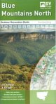
Blue Mountains North Map; Spatial Vision
Spatial Vision; Outdoor Recreation Guide 1:50,000
Blue Mountains National Parks, Yellomundee Regional Park LOCAL TOWNS including Mount Victoria, Blackheath, Medlow Bath, Katoomba, Leura, Wentworth Falls, Lawson, Springwood, Glenbrook.
Detailed walk descriptions including day walks such as the Grand Canyon and Prince Henry Cliff walk and overnight walks including Blue Gum Forest Circuit, Mount Victoria to Blue Gum Forest and Blackheath.
Information on other activities such as mountain biking, rock climbing, canyoning, canoeing and swimming.
Campground and Lookout locations and GPS references
1:25, 000 map inset of the Katoomba and Wentworth Falls area
Walk cross sections |
|
|
2.
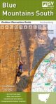
Blue Mountains South Map; Spatial Vision
Spatial Vision; Outdoor Recreation Guide 1:50,000
Kanangra-Boyd and Blue Mountains National Parks, Burragorang State Conservation Area
Map inset of the famous Six Foot track
Detailed walk descriptions including day walks such as the Three Sisters, Lawson Waterfalls, Red Hands cave, Ruined Castle and overnight walks such as Mount Solitary, Blue Labyrinth, Wild Dog Mountains and Kanangra-Boyd Wilderness
Information on other activities such as cultural and natural heritage, car touring and 4WD, mountain biking, rock climbing, canyoning, canoeing and swimming.
Campground and Lookout locations and GPS reference
Walk cross sections |
|
|
3.
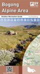
Bogong Alpine Area; Spatial Vision
Spatial Vision Outdoor Recreation Guide
SCALE: 1:50,000: Falls Creek, Mt Hotham, Dinner Plain and Mt Bogong For Bushwalking, Cross-country skiing, mountain biking and car touring. First Edition 1000mm wide by 810mm high
The Bogong Alpine Area recreation guide has been developed in consultation with Parks Victoria and includes touring information by Glenn van der Knijff, a well known adventure author |
|
|
4.
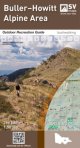
Buller-Howitt Alpine Area; Spatial Vision
Spatial Vision Outdoor Recreation Guide
SCALE: 1:50,000; Mt Buller, Mt Stirling, Mt Howitt, Wonnangatta Station. For bushwalking, Cross-country skiing, mountain biking and car touring. First Edition 1000mm wide by 675mm high
The Buller-Howitt Alpine Area recreation guide has visitor information regarding overnight hiking, walking tracks, major activities, car and four wheel touring as well as flora and fauna |
|
|
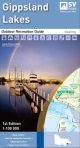
5.
Gippsland Lakes; Spatial Vision
Spatial Vision Outdoor Recreation Guide
SCALE: 1:100,000 Nicholson, Mitchell, Tambo and Latrobe River Entrance, Loch Sport, Metung, Lakes Entrance. Ideal for Boating, bushwalking, cycling and car touring, First Edition
Size 945mm w x 750mm The Gippsland Lakes recreation guide has been developed in consultation with Parks VictoriaPort, East Gippsland and Wellingtons Shires |
|
|
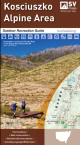
6.
Kosciuszko Alpine Area; Spatial Vision
Spatial Vision Outdoor Recreation Guide
Scale: 1:50,000 Khancoban, Jindabyne, Thredbo, Perisher Valley. Ideal for Bushwalking, cross-country skiing, rock climbing, mountain biking and car touring.
First Edition 1000mm w x 810mm h The Kosciuszko Alpine Area Outdoor Recreation Guide has detailed walk descriptions of some of the most popular walks in the area, including the Main Range Track, the Kosciuszko Walk and walks in the Jagungal Wilderness. Detailed route notes indicate walk times, distance and level of difficulty of each walk. |
|
|
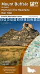
7.
Mount Buffalo Area; Spatial Vision
Spatial Vision Outdoor Recreation Guide
Scale: 1:30,000; Mount Buffalo National Park, Myrtleford, Porepunkah and Lake Buffalo. For Bushwalking, Cross-country skiing, mountain biking and car touring. First Edition
Size 810mm wx x1000m h The Mount Buffalo recreation guide provides information and detailed maps for walking and touring throughout the National Park and surroundings, complimenting the Bogong Alpinme and Buller-Howitt guides. |
|
|
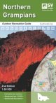
8.
Northern Grampians Outdoor Recreation Guide; Spatial Vision
Spatial Vision Outdoor Recreation Guide
Scale: 1:50,000 Halls Gap, Dadswells Bridge, Zumstein, Moora Moora Reservoir, Wartook Reservoir, and Lake Lonsdale For Bushwalking, mountain biking and car touring
First Editon 675mm w x 100mm high The Northern Grampians recreation guide provides detailed maps for walking, overnight hiking, walking tracks, major activities, car and four wheel touring as well as flora and fauna. It also contains information about the many walks (difficulty, distance, time and elevation) major activities and local contact information. |
|
|
9.
Southern Grampians Outdoor Recreation Guide; Spatial Vision
Spatial Vision Outdoor Recreation Guide
Scale: 1:50,000 Dunkeld, Wannon, Glenthompson (Southern end of Grampians National Park) For Bushwalking, mountain biking and car touring
First Edition Size 675mm w x 1000mm h. This guide provides detailed maps for walking, overnight hiking, walking tracks, major activities, car and four wheel touring as well as flora and fauna. Made in conjunction with Parks Victoria, the guide also contains information about the many walks (difficulty, distance, time and elevation), major activities and local contact information |
|
|
10.
Otways Central, Walks and Waterfalls
Spatial Vision Outdoor Recreation Guide
1:50 000, Apollo Bay and Marengo insets; Forrest MTB trails map; Detailed walks descriptions and recreation site locations. |
|
|
11.
Otways East; Surf coast
Spatial Vision Outdoor Recreation Guide
1:50 000, Torquay and Lorne insets; Detailed walks descriptions and recreation site locations. |
|
|
12.
Otways West; Shipwreck Coast
Spatial Vision Outdoor Recreation Guide
This new map of the Shipwreck Coast (Otways West) provides detailed topographic information to explore the region and the many recreational features on offer. This fascinating region includes the Great Otway National Park, Twelve Apostles Marine Park and Port Campbell National Park. Coverage for Apollo Bay to Peterborough, including Port Campbell, the Twelve Apostles, Princetown, Beech Forest and Lavers Hill. 1:50 000 scale |
|
|
13.
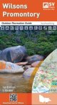
Wilsons Promontory
Spatial Vision Outdoor Recreation Guide, 1:50 000
Wilsons Promontory National Park, Wilsons Promontory Marine National Park, Corner Inlet Marine National Park, Wilsons Promontory Marine Reserve, Corner Inlet Marine and Coastal Park |
|
|
14.
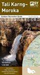
Tali Karng Moroka
Spatial Vision Outdoor Recreation Guide
The newest addition to the series, this guide contains a detailed map of the region at 1:50,000 scale, covering the key locations of Dargo and Licola. The map covers the historic gold mining towns of Grant and Talbotville; walking trails such as McMillans Track and a section of the Bicentennial National Trail, and magnificent bushwalking destinations including Moroka Gorge, Lake Tali Karng and The Crinoline |
|
|
| |
Your Basket
0 items in basket
|
|

