|
1.
Take a Walk in Northern Territory's National Parks - Bushwalking
There's over 1000 kilometres of walk descriptions, complete with sketch maps and colour photos. Complete track notes for one of the world's 'classic walks', the 233 kilometre Larapinta Trail, are included, as well as a selection of day walks along sections of that trail. |
|
|
2.
Top End National Parks
Hema; Litchfield, Katherine, Kakadu |
|
|
3.
Photographing Uluru
Beaten Track; A photographic souvenir of Uluru - Kata Tjuta National Park. Photography by Allan Fox, Text by Peter and Allan Fox |
|
|
4.
Uluru - Kata Tjuta National Park
Geoscience Australia; Scale 1:100 000 Opened Size: 995 x 700 mm |
|
|
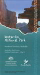
5.
Watarrka National Park
Geoscience Australia; Scale 1:100 000 Opened Size: 875 x 470 mm |
|
|
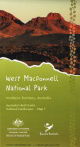
6.
West Macdonnell National Park Map 1
Geoscience Australia; Two 1:100 000 scale topographic maps covering the West MacDonnell Ranges in the Northern Territory have been produced in collaboration with Parks Australia, Department of Resources, Energy and Tourism and Northern Territory government agencies.
The maps are entitled West MacDonnell Ranges National Park Map 1 (western section) and West MacDonnell Ranges National Park Map 2 (eastern section) and are part of a pilot program to map Australia?s Red Centre: Australia?s National Landscapes . This program is an initiative of Parks Australia to identify and promote distinctive and inspirational destinations to domestic and international visitors.
The maps contain satellite images on the reverse side and have applications for:
- Emergency management support and planning
- Navigation and tourist resources in a remote and rugged landscape
- Visitors seeking attractive and informative mementos of the Red Centre.
Click on images to see key map for coverage |
|
|
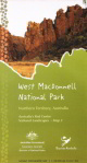
7.
West Macdonnell National Park Map 2
Geoscience Australia; Two 1:100 000 scale topographic maps covering the West MacDonnell Ranges in the Northern Territory have been produced in collaboration with Parks Australia, Department of Resources, Energy and Tourism and Northern Territory government agencies.
The maps are entitled West MacDonnell Ranges National Park Map 1 (western section) and West MacDonnell Ranges National Park Map 2 (eastern section) and are part of a pilot program to map Australia?s Red Centre: Australia?s National Landscapes . This program is an initiative of Parks Australia to identify and promote distinctive and inspirational destinations to domestic and international visitors.
The maps contain satellite images on the reverse side and have applications for:
- Emergency management support and planning
- Navigation and tourist resources in a remote and rugged landscape
- Visitors seeking attractive and informative mementos of the Red Centre.
Click on images to see key map for coverage |
|

