Home Page    |   Contact Us   
   Custom Mapping Specialists    |    Awards    |    Online Shopping    |    Promotional Map Products   
Home
About Cartodraft

ONLINE SHOPPING

Browse online shop

- Road Atlas
- Road Atlas - Vic
- Road Atlas - Tas
- Road Atlas - Qld
- Road Atlas - NT/SA
- Road Atlas - WA
- Touring Recreational Guides
- Cycling
- Canoe and Kayak

Delivery and Order Information

CRAIGIES MAPS

- Visitors Maps
- Touring Maps
- State Maps
- Street Directories
- Laminated Maps

WALL MAPS

- Laminated

EDUCATIONAL WALL MAPS

- World Political
- Australia and its Neighbours
- Australia Political
- Australia Physical
- New South Wales

POSTCODE MAPS

- Postcode Maps

CUSTOM MAPPING

- Custom Mapping Services
- Showcase

MAP ENLARGEMENTS

- Mapping Enlargements

WEBSITE MAPPING

- Maps for websites
- Showcase

LAMINATING SERVICE

- Lamination Services

PRINTING SERVICE

- Printing Services

DIGITAL MAPS

- International
- Australian
- New Zealand

GPS

- Hema Navigator

GROOVY MAPS

- Maps & Guides

SATELLITE MAPS AND POSTERS

- Satellite Maps and Posters

TOPOGRAPHIC MAPS

- NSW Lands
- NATMAP 1:50,000
- NATMAP 1:100,000
- NATMAP 1:250,000
- National
- NATMAP PNG
- Raster CD & DVD

MAP AND PLAN MEASURING TOOLS

- Scalex Map Wheel™
- Scalex Plan Wheel™

CARTOGRAPHY BOOKS

- Getting there from Here
- The States of a Nation

PROMOTIONAL PRODUCTS

- Desk Pads, Courtesy maps and more

CD AND DVD PRODUCTS

- Digital Street Directories
- Postcodes Australia and DVD Products
- Topographic Maps and DVD Products
- CD Maps

INTERNATIONAL MAPS

- Countries/Regions A-D
- Countries/Regions E-H
- Countries/Regions I-L
- Countries/Regions M-P
- Countries/Regions S-U
- Groovy Map 'n Guide

STREET DIRECTORIES

- Street Directory -ACT
- Street Directory -NSW
- Street Directory -NT
- Street Directory -QLD
- Street Directory -SA
- Street Directory -VIC
- Street Directory -WA
- Street Directory -NZ

ATLASES AND GUIDES

- Road Atlases
- Touring & Recreational Guides

TOURING MAPS

- City to City Touring Maps

WORLD MAPS

- World Maps

AUSTRALIAN MAPS

- Australian Maps

FORESTRY MAPS

- Forestry Maps - NSW

NATIONAL PARK MAPS

- National Park Maps - NSW
- National Park Maps - Vic
- National Park Maps - Qld
- National Park Maps - Tas

4WD MAPS & GUIDES

- Great Desert Track Series
- 4 Wheel Driving Maps
- 4 Wheel Driving Guides
- 4 Wheel Driving CD's

CITY MAPS

- Major Cities A-B
- Major Cities C-L
- Major Cities M-P
- Major Cities S-Z
- Regional Cities

REGIONAL MAPS

- Regional Maps -NSW
- Regional Maps -NT
- Regional Maps -QLD
- Regional Maps -SA
- Regional Maps -VIC
- Regional Maps -WA
- Regional Maps -TAS

STATE MAPS

- State Maps -NSW
- State Maps -NT
- State Maps -Queensland
- State Maps -SA
- State Maps -Victoria
- State Maps -WA
- State Maps -Tasmania

NEW ZEALAND MAPS

- New Zealand - Atlases
- New Zealand - Maps
- New Zealand - City Maps
- New Zealand - Street Directories
- New Zealand - Regional Maps
- New Zealand - Laminated Maps
Awards
Links
Terms and conditions
Privacy Policy
Information Request/Contact

Road Atlas - Tas


3 steps to ordering maps from Cartodraft:
  • Enter quantity required next to Qty.
  • Click on the Buy button. Add more products by clicking Continue Shopping button
  • To complete your purchase, click on CHECKOUT button.

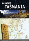
Touring Tasmania  - (WHOLESALE orders only)   1. Touring Tasmania - (WHOLESALE orders only)

Tasmap; The Tasmanian Touring Guide features the Touring Routes around the state. Each route is featured in the book with a detailed, colour coded map, feature photos and informative notes about the regions attractions.The Central Highlands, King and Flinders Islands are featured in the same style.
Tasmania”s city areas are featured in the second section. Detailed, large scale maps, photographs and informative notes capture the essence of the cities and highlight the main attractions in the area.Lifestyle and activities are described and illustrated on the Take it EasyŒ and Try it WildŒ pages. Also includeds a Towns Gazetteer which lists all localities in the state and indicates whether fuel, meals, accommodation, caravan parks, camping or Tasmanian Visitor Information Centre are available.
RAG050 $13.50 ea   Qty

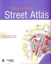
Tasmanian Towns Street Atlas  - (WHOLESALE orders only)   2. Tasmanian Towns Street Atlas - (WHOLESALE orders only)

Tasmap; This 304 page atlas portrays Tasmania's cities, towns and urban areas. 246 individual maps at a scale of 1:15000 show roads and streets along with other community and government facilities of interest, all of which are cross-referenced in the street index or gazetteer. Towns, Suburbs and Localities are quickly located from an alphabetical listing on page six or from the following regional or state wide index maps. Additional pages include larger scale city and town centre maps.
RAG051 $29.95 ea   Qty

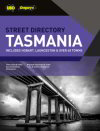
Tasmania   3. Tasmania

UBD; Over 72 updated City & Town Maps including Beaconsfield, Bridgewater, Devonport, Hobart, Launceston, New Norfolk, Port Sorell, St Marys, Smithton, Strahan & Zeehan
Information on 12 region areas of Tasmania :Hobart; South East; Huon, Channel & Bruny; East Coast; Midlands; Derwent Valley & Central Highlands; West Coast; North East; Flinders Island; Launceston & Tamar Valley; Central North & Cradle Mountain; North West & King Island
SD035 $34.99 ea   Qty

Your Basket

0 items in basket


   Copyright Cartodraft P/L 2001-2019   Online map store Contact Cartodraft