
|
1.
Melbourne's Best Picnic Spots & Beaches
Melbourne has something for everyone, with many beaches, open parklands and pristine national parks. Melbourne's best Picnic Spots includes: Over 100 great locations; From the Dandenong's to Daylesford, from the Mornington to the Bellarine Peninsulas; Over 150 full colour photos; Detailed full colour maps; A summary table to help you quickly find your spot; Information on Melbourne's history and environment. |
|
|
2.
Great Ocean Walk Information Guide & Map - Parks Victoria
Meridian; Scale 1 : 25 000 Topographic Map. 1st Edition. Easy to read format. Detailed topographic coverage. Routes notes & planning information |
|
|
3.
Lower Glenelg and Discovery Bay Map
Meridian Maps and Carto Graphics. This new double sided, 1:50,000 scale topographic map, covers the Glenelg River from Dartmoor to Nelson and the river mouth and the complete Great South West Walk circling from Portland to Nelson and back again. |
|
|
4.
Top Walks in Victoria
Explore Australia; Victoria offers a jaw-dropping diversity of bushwalks through areas rich in natural wonders and colourful human history. Experienced travel writer Melanie Ball has hiked every track in this book for walkers of all levels of experience. There are walks for each part of the state, including the renowned Wilsons Promontory Lighthouse loop and salt lake circuits in the Mallee region. Most of the tracks can be completed in a few hours, but there are some more difficult multi-day walks for those wanting more of a challenge. For each walk there is detailed trail information, a map, photographs and beautiful illustrations of fauna and flora that you?re likely to see along the way. |
|
|
5.
100 Walks in Tasmania
Explore Australia; Paperback,By Tyrone Thomas and Andrew Close
Tyrone Thomas, the author of Australia's most successful walking guidebook series, in association with Andrew Close, has gathered the best that Tasmania has to offer in, 100 Walks in Tasmania. The guide includes all of the classic walks such as Wineglass Bay, Dove Lake and Walls of Jerusalem, as well as some lesser-known gems of the Tasmanian wilderness. Each walk is graded easy, medium or hard, providing walks to suit every level. Thomas and Close have designed their trails with the environment in mind, to ensure the protection of Tasmania's precious landscapes. This is the definitive guide to walking in Tasmania with 125 detailed maps, comprehensive track notes and other useful information. |
|
|
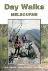
6.
Day Walks Melbourne
Waymore: by John Chapman, Monica Chapman & John Siseman. Describes 41 walking areas around Melbourne with a total of 94 walk variations. For each walking area, one walk is described in detail and a series of variations based on the main walk are also given if appropriate. Areas covered range from Torquay, Barwon Heads, Geelong, You Yangs, Brisbane Ranges, Creswick, Daylesford, Lerderderg Gorge, Altona, Westerfolds Park, Jells Park, Braeside Park, Mordialloc, Birds Land, Sherbrooke Forest, Olinda Forest, Kinglake, Maroondam Dam, Black Spur, Cathedral Range, Lake Eildon, Gembrook, Powelltown, Cape Woolami and Fort Nepean. |
|
|
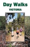
7.
Day Walks Victoria
Waymore: by John Chapman, Monica Chapman & John Siseman. Describes 40 walking areas around Victoria with a total of 96 walk variationss. For each walking area, one walk is described in detail and a series of variations based on the main walk are also given if appropriate. Areas covered range from Portland, Grampians, Enfield Forest, Cape Otway, Aireys Inlet, Angelsea, Daylesford, Swan Bay, Point Cooke, Gellibrand Hill, Mt Macedon, Brisbane Ranges, Lysterfield & Churchill Parks, Dandenongs, Cape Schanck, Phillip Island, Mt St Leonard, Fraser National Park, Mt Baw Baw, Alpine National Park and others. For those based in Melbourne, 23 of the walking areas are within day walk distance of Melbourne. |
|
|
| |
Your Basket
0 items in basket
|
|

