Home Page    |   Contact Us   
   Custom Mapping Specialists    |    Awards    |    Online Shopping    |    Promotional Map Products   
Home
About Cartodraft

ONLINE SHOPPING

Browse online shop

- National Park Maps - NSW
- National Park Maps - Vic
- National Park Maps - Qld
- National Park Maps - NT
- National Park Maps - WA
- National Park Maps - Tas

Delivery and Order Information

CRAIGIES MAPS

- Visitors Maps
- Touring Maps
- State Maps
- Street Directories
- Laminated Maps

WALL MAPS

- Laminated

EDUCATIONAL WALL MAPS

- World Political
- Australia and its Neighbours
- Australia Political
- Australia Physical
- New South Wales

POSTCODE MAPS

- Postcode Maps

CUSTOM MAPPING

- Custom Mapping Services
- Showcase

MAP ENLARGEMENTS

- Mapping Enlargements

WEBSITE MAPPING

- Maps for websites
- Showcase

LAMINATING SERVICE

- Lamination Services

PRINTING SERVICE

- Printing Services

DIGITAL MAPS

- International
- Australian
- New Zealand

GPS

- Hema Navigator

GROOVY MAPS

- Maps & Guides

SATELLITE MAPS AND POSTERS

- Satellite Maps and Posters

TOPOGRAPHIC MAPS

- NSW Lands
- NATMAP 1:50,000
- NATMAP 1:100,000
- NATMAP 1:250,000
- National
- NATMAP PNG
- Raster CD & DVD

MAP AND PLAN MEASURING TOOLS

- Scalex Map Wheel™
- Scalex Plan Wheel™

CARTOGRAPHY BOOKS

- Getting there from Here
- The States of a Nation

PROMOTIONAL PRODUCTS

- Desk Pads, Courtesy maps and more

CD AND DVD PRODUCTS

- Digital Street Directories
- Postcodes Australia and DVD Products
- Topographic Maps and DVD Products
- CD Maps

INTERNATIONAL MAPS

- Countries/Regions A-D
- Countries/Regions E-H
- Countries/Regions I-L
- Countries/Regions M-P
- Countries/Regions S-U
- Groovy Map 'n Guide

STREET DIRECTORIES

- Street Directory -ACT
- Street Directory -NSW
- Street Directory -NT
- Street Directory -QLD
- Street Directory -SA
- Street Directory -VIC
- Street Directory -WA
- Street Directory -NZ

ATLASES AND GUIDES

- Road Atlases
- Touring & Recreational Guides

TOURING MAPS

- City to City Touring Maps

WORLD MAPS

- World Maps

AUSTRALIAN MAPS

- Australian Maps

FORESTRY MAPS

- Forestry Maps - NSW

NATIONAL PARK MAPS

- National Park Maps - NSW
- National Park Maps - Vic
- National Park Maps - Qld
- National Park Maps - Tas

4WD MAPS & GUIDES

- Great Desert Track Series
- 4 Wheel Driving Maps
- 4 Wheel Driving Guides
- 4 Wheel Driving CD's

CITY MAPS

- Major Cities A-B
- Major Cities C-L
- Major Cities M-P
- Major Cities S-Z
- Regional Cities

REGIONAL MAPS

- Regional Maps -NSW
- Regional Maps -NT
- Regional Maps -QLD
- Regional Maps -SA
- Regional Maps -VIC
- Regional Maps -WA
- Regional Maps -TAS

STATE MAPS

- State Maps -NSW
- State Maps -NT
- State Maps -Queensland
- State Maps -SA
- State Maps -Victoria
- State Maps -WA
- State Maps -Tasmania

NEW ZEALAND MAPS

- New Zealand - Atlases
- New Zealand - Maps
- New Zealand - City Maps
- New Zealand - Street Directories
- New Zealand - Regional Maps
- New Zealand - Laminated Maps
Awards
Links
Terms and conditions
Privacy Policy
Information Request/Contact

National Park Maps - NSW


3 steps to ordering maps from Cartodraft:
  • Enter quantity required next to Qty.
  • Click on the Buy button. Add more products by clicking Continue Shopping button
  • To complete your purchase, click on CHECKOUT button.

Take a Walk in Southern NSW & the ACT - Bushwalking   1. Take a Walk in Southern NSW & the ACT - Bushwalking

This eleventh book in the Take A Walk series includes more than 2000 km of walk descriptions in over 30 national parks, between Sydney and the Victorian Border. Day walks, rated from easy to hard; challenging overnight hikes, and multi-day expeditions will have readers planning trip after trip. Sketch maps and gradient profiles; photos; how to get there; and notes about the parks and reserves and their unique landforms, plants, birds and animals will add to their walking pleasure. There?s something in this exciting new edition to suit everyone - from families with children, to active travellers and hard-core bushwalkers.
BSHW03 $34.95 ea   Qty

Blue Mountains National Parks   2. Blue Mountains National Parks

Craigies; Blue Mountains National Park Map covers the Blue Mountains, Kanangra-Boyd and Abercrombie River National Parks extending from Lidsdale in the north to Wombeyan Caves and Bargo in the south.
This very detailed map includes road, highways, road shields, suburbs and towns. Wilderness, forest and water catchment boundaries are also marked along with a handy grid for the 1:25 000 NSW topographic map coverage.
A very useful map for a complete overview of the Blue Mountains region it allows visitors to plan their journeys, with many fire trails and walking routes noted. The reverse side features detailed town maps of Blue Mountains townships including Blackheath, Medlow Bath, Katoomba, Leura, Wentworth Falls, BullaburraHazelbrook, Woodford, Faulconbridge, Springwood, Valley Heights, Warrimoo, Blaxland, Glenbrook, Mount Riverview and Lapstone.
Also included are mud maps for Blackheath, Katoomba, Leura and Wentworth Falls walking tracks noting lookouts, walking times and track grades.
National Parks Map Scale 1:130,000
Size (unfolded) 700 x 1000mm 1000 x 690mm
REG001 $12.95 ea   Qty

Warrumbungle National Park, Guide to Walks   3. Warrumbungle National Park, Guide to Walks

Beaten Track; Walks Guide includes detailed track notes for the Breadknife, Grand High Tops, Bluff Mountain and Mount Exmouth walks. By Peter Fox and Paul Shelley
NTPK26 $6.95 ea   Qty

Warrumbungle National Park Guidebook   4. Warrumbungle National Park Guidebook

Beaten Track; Guidebook for the Warrumbungle National Park. 2nd Edition 2010 By Peter Fox and Paul Shelley
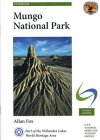
NTPK33 $14.95 ea   Qty

Mungo National Park Guidebook   5. Mungo National Park Guidebook

Beaten Track; Guidebook for the Mungo National Park. Part of the Willandra Lakes World Heritage Area 4th Edition 2010 By Allan Fox
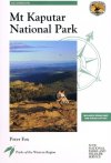
NTPK28 $13.50 ea   Qty

Mt Kaputar National Park Guidebook   6. Mt Kaputar National Park Guidebook

Beaten Track; Guidebook for the Mt Kaputar National Park. Part of the Western Region 1994. By Peter Fox. Includes Bonus Map and Walks Liftout
NTPK29 $9.95 ea   Qty

Your Basket

0 items in basket


   Copyright Cartodraft P/L 2001-2019   Online map store Contact Cartodraft