|
1.
Brisbane to Cairns
Hema; An easy-to-follow map that shows both the coastal and inland routes from Brisbane to Cairns. Roadside rest areas, intermediate distances, and a quick-find distance chart are also shown. The map shows all the popular tourist destinations along the Queensland coast. |
|
|
2.
Brisbane to Cairns 444
UBD/Greg; Size 575 x 920mm
Detailed map coverage of The Queensland Region between Brisbane and Cairns, highlighting the Bruce Highway and offering information on Alternative Routes. Unique strip maps offering detailed information on attractions, facilities and distances en route. Editorial on selected main attractions. Checklist of tourist information centres and National Parks. |
|
|
3.
Cairns to Broome Savannah Way
Hema; Find out all you need to know about travelling the Savannah Way between Cairns and Broome. As well as providing a detailed road map for the entire length of the Savannah Way, this map includes handy advice on road conditions, average rainfall and safe driving tips. The useful information also highlights the features you pass in Queensland, Northern Territory and Western Australia. |
|
|
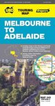
4.
Melbourne to Adelaide
Hema; The map coverage highlights three major routes between the cities, as well as including numerous alternate connecting highways. In addition, there is an inset map covering the key Great Ocean Road route in more detail. As well as points of interest being highlighted on the map, there's plenty of helpful information on all the things to see and do while you're travelling. A handy list of contact numbers for further information and details of the facilities in national parks are also included. |
|
|
5.
Melbourne to Adelaide 345
UBD Gregory's; 345 Size 690 x 920mm |
|
|
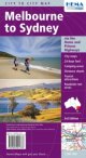
6.
Melbourne to Sydney
Hema; This map takes you from Melbourne to Sydney via the Princes and Hume Highways and everything in between. The map also features text and photographs of places of interest along the way. Also included on the map is National Park information and inset maps of the major roads through Sydney and Melbourne. |
|
|
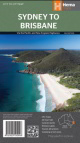
7.
Sydney to Brisbane
Hema; A city-to-city map that stretches from Sydney to Brisbane that is accompanied by throughroads maps of Sydney and Brisbane. This map covers the two major eastern routes between Sydney and Brisbane - the Pacific and New England Highways. There is tourist information for the trip via the Pacific and New England Highways. Marked on the mapping are caravan parks, camping and rest areas, while a distance grid and national park matrix are also included.
All major towns, roads, national parks and additional information such as rest stops, points of interest, 24-hour fuel stops, and camping areas are clearly marked.
City maps
24-hour fuel
Camping areas
Distance charts
Tourist attractions
Roadside rest areas |
|
|
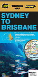
8.
Sydney to Brisbane 244
UBD Gregory's; Size 575 x 920mm
Touring Map covering Sydney to Brisbane via the New England and Pacific Highways. Includes things to do along the way. |
|
|
9.
Sydney to Melbourne 245
UBD Gregory's; Size 575 x 920mm
Detailed map coverage from Melbourne to Sydney via the Hume or the Princes Highways. |
|
|
10.
Adelaide-Melbourne
Meridian Maps;
Scale 1:1,250,000, Size 840 x 500mm
Major Touring Routes; Strip maps; City Approach Maps; Tourist points of interest; Visitor Information Centres; Clear & easy to read; Single sided wall map. |
|

