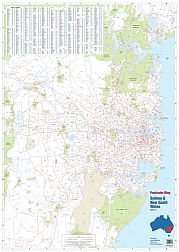
Release 2012 Fully updated to run faster, smoother and handle larger data sets with data from the 2011 Australian Census. Produce sales and franchise territories; map branch or customer locations; produce maps showing sales data; enhance the maps by plotting from a library of key demographics; create customised postcode maps for any part of Australia; postcode definitions as at August 2012; full range of mapping functions including zoom; pan; change colours; patterns and labels; includes postcodes; major roads; parks; reserves; recreation areas; waterways; rivers and lakes.