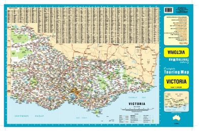
Home Page    |   Contact Us   
   Custom Mapping Specialists    |    Awards    |    Online Shopping    |    Promotional Map Products   
Home
About Cartodraft

ONLINE SHOPPING

Browse online shop

- Craigies Street Directories

Delivery and Order Information

CRAIGIES MAPS

- Visitors Maps
- Touring Maps
- State Maps
- Street Directories
- Laminated Maps

WALL MAPS

- Laminated

EDUCATIONAL WALL MAPS

- World Political
- Australia and its Neighbours
- Australia Political
- Australia Physical
- New South Wales

POSTCODE MAPS

- Postcode Maps

CUSTOM MAPPING

- Custom Mapping Services
- Showcase

MAP ENLARGEMENTS

- Mapping Enlargements

WEBSITE MAPPING

- Maps for websites
- Showcase

LAMINATING SERVICE

- Lamination Services

PRINTING SERVICE

- Printing Services

DIGITAL MAPS

- International
- Australian
- New Zealand

GPS

- Hema Navigator

GROOVY MAPS

- Maps & Guides

SATELLITE MAPS AND POSTERS

- Satellite Maps and Posters

TOPOGRAPHIC MAPS

- NSW Lands
- NATMAP 1:50,000
- NATMAP 1:100,000
- NATMAP 1:250,000
- National
- NATMAP PNG
- Raster CD & DVD

MAP AND PLAN MEASURING TOOLS

- Scalex Map Wheel™
- Scalex Plan Wheel™

CARTOGRAPHY BOOKS

- Getting there from Here
- The States of a Nation

PROMOTIONAL PRODUCTS

- Desk Pads, Courtesy maps and more

CD AND DVD PRODUCTS

- Digital Street Directories
- Postcodes Australia and DVD Products
- Topographic Maps and DVD Products
- CD Maps

INTERNATIONAL MAPS

- Countries/Regions A-D
- Countries/Regions E-H
- Countries/Regions I-L
- Countries/Regions M-P
- Countries/Regions S-U
- Groovy Map 'n Guide

STREET DIRECTORIES

- Street Directory -ACT
- Street Directory -NSW
- Street Directory -NT
- Street Directory -QLD
- Street Directory -SA
- Street Directory -VIC
- Street Directory -WA
- Street Directory -NZ

ATLASES AND GUIDES

- Road Atlases
- Touring & Recreational Guides

TOURING MAPS

- City to City Touring Maps

WORLD MAPS

- World Maps

AUSTRALIAN MAPS

- Australian Maps

FORESTRY MAPS

- Forestry Maps - NSW

NATIONAL PARK MAPS

- National Park Maps - NSW
- National Park Maps - Vic
- National Park Maps - Qld
- National Park Maps - Tas

4WD MAPS & GUIDES

- Great Desert Track Series
- 4 Wheel Driving Maps
- 4 Wheel Driving Guides
- 4 Wheel Driving CD's

CITY MAPS

- Major Cities A-B
- Major Cities C-L
- Major Cities M-P
- Major Cities S-Z
- Regional Cities

REGIONAL MAPS

- Regional Maps -NSW
- Regional Maps -NT
- Regional Maps -QLD
- Regional Maps -SA
- Regional Maps -VIC
- Regional Maps -WA
- Regional Maps -TAS

STATE MAPS

- State Maps -NSW
- State Maps -NT
- State Maps -Queensland
- State Maps -SA
- State Maps -Victoria
- State Maps -WA
- State Maps -Tasmania

NEW ZEALAND MAPS

- New Zealand - Atlases
- New Zealand - Maps
- New Zealand - City Maps
- New Zealand - Street Directories
- New Zealand - Regional Maps
- New Zealand - Laminated Maps
Awards
Links
Terms and conditions
Privacy Policy
Information Request/Contact

Craigies Street Directories - Southern Highlands & Wollondilly Street Directory 2nd Edition


Craigies Street Directories > Southern Highlands & Wollondilly Street Directory 2nd Edition

3 steps to ordering maps from Cartodraft:
  • Enter quantity required next to Qty.
  • Click on the Buy button. Add more products by clicking Continue Shopping button
  • To complete your purchase, click on CHECKOUT button.

Southern Highlands & Wollondilly Street Directory 2nd Edition
Craigies; The Southern Highlands & Wollondilly Street Directory is a Comprehensive Guide to the Streets and Roads within the Southern Highlands and Wollondilly Shires which extends from Warragamba and Silverdale in the North to Goulburn in the South and Crookwell in the West

Including detailed Street Maps of Alpine, Alymerton, Appin , Balmoral, Bargo, Berrima, Berrima Junction, Bowral, Bradfordville, Braemar, Brooklands, Bundanoon, Bungonia, Burradoo, Burrawang, Buxton, Colo Vale, Couridjah, Crestwood, Crookwell, Douglas Park, Eastgrove, Exeter, Fitzroy Falls, Garfield, Goulburn, Goulburn South, Hill Top, Ifield, Kenmore, Maldon, Marulan, Medway, Menangle, Mittagong, Moss Vale, Mowbray Park, Mt Hunter, North Goulburn, Oakdale, Penrose, Picton, Robertson, Run-O-Water, Silverdale, Sutton Forest, Tahmoor, Tallong, Tarago, The Oaks, Thirlmere, Warragamba, Welby, Wilton, Wingello, Yanderra, Yerrinbool.

SD002 $19.95 ea   Qty

Your Basket

0 items in basket


   Copyright Cartodraft P/L 2001-2019   Online map store Contact Cartodraft