|
1.
Australia Handy
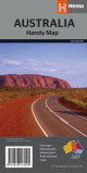
Hema; The Australia Handy Map is perfect as a journey planner or reference tool for interstate travellers. The mapping shows national parks and major road networks with distances for planning, along with major city CBD maps for Brisbane, Melbourne, Sydney, Canberra, Darwin, Adelaide, Perth and Hobart, as well as a distance chart and a placename index for practical use. Updated highways, roads and national parks. * City maps * National parks * Distance grid * Road distances * Index |
|
|
2.
Australia Large
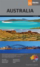
Hema Scale 1:4,500,000 The most comprehensive road map available for Australia. The map features more roads and road distances than have ever been shown on a map of Australia, with reliable differentiation between major, minor, sealed and unsealed roads. A beautiful map of Australia. In addition all Australian city and throughroads maps are printed on the back |
|
|
3.
Australia Road & Terrain
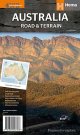
Hema; This is the only map of Australia showing comprehensive road detail and road distances as well as contour shading. The road detail comes from the award-winning Hema Australia Map and the hill shading is hand drawn from a digital terrain model and printed as a separate colour. This not only makes the map extremely attractive, but it also ensures it accurately depicts the terrain. Also available as a wall map |
|
|
4.
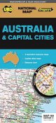
Australia and official tourist regions 149
UBD Gregory's; 690 x 920mm |
|
|
5.
Australia 180
UBD Gregory's; Size 690 x 1000m Synthetic Paper |
|
|
6.
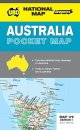
Australia Pocket Map 179
UBD Gregory's; Size 159 x 115 mm |
|
|
7.
Australia Map
Meridian Maps;
Scale 1:4,750,000 Size 1003 x 865mm; Large format wall map; Terrain & bathymetric detail; Country comparisons & territories maps; Unique features for clarity & detail; Single sided wall map |
|
|
8.
Australia Wall Map
Meridian Maps; Scale 1:4,750,000 Size 1003 x 865mm
Large format wall map with terrain & bathymetric detail, Country comparisons & territories maps; Single sided wall map |
|
|
9.
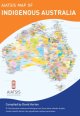
Aboriginal Australia Wall Map (A3)
AIASIS: Folded A3 Wall Map: 420 x 297mm
The highly popular AIATSIS map of Indigenous Australia is now available in a compact, portable A3 size. Available folded (packaged in a cellophane bag), it?s the perfect take-home product for tourists and anyone interested in the diversity of Australia?s first nations peoples. The handy desk size also makes it an ideal resource for individual student use.
Using published resources available from 1988?994, the map attempts to represent the language or nation groups of Aboriginal and Torres Strait Islander peoples of Australia.
For tens of thousands of years, the First Australians have occupied this continent as many different nations with diverse cultural relationships linking them to their own particular lands. The ancestral creative beings left languages on country, along with the first peoples and their cultures.
More than 200 distinct languages, and countless dialects of them, were in use when European colonisation began. While people in some communities continue to speak their own languages, many others are seeking to record and revive threatened ones. Aboriginal and Torres Strait Islander peoples retain their connection to their traditional lands regardless of where they live. |
|
|
10.
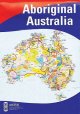
Aboriginal Australia Wall Map (Sml)
AIASIS: Folded A3 Wall Map: 420 x 297mm
The highly popular AIATSIS map of Indigenous Australia is now available in a compact, portable A3 size. Available folded (packaged in a cellophane bag), it?s the perfect take-home product for tourists and anyone interested in the diversity of Australia?s first nations peoples. The handy desk size also makes it an ideal resource for individual student use.
Using published resources available from 1988?994, the map attempts to represent the language or nation groups of Aboriginal and Torres Strait Islander peoples of Australia.
For tens of thousands of years, the First Australians have occupied this continent as many different nations with diverse cultural relationships linking them to their own particular lands. The ancestral creative beings left languages on country, along with the first peoples and their cultures.
More than 200 distinct languages, and countless dialects of them, were in use when European colonisation began. While people in some communities continue to speak their own languages, many others are seeking to record and revive threatened ones. Aboriginal and Torres Strait Islander peoples retain their connection to their traditional lands regardless of where they live. |
|
|
11.
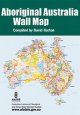
Aboriginal Australia Wall Map (Lge)
AIASIS: Folded Large Wall Map:1189 x 841mm
The Aboriginal Australia map (edited by David Horton) The map represents research carried out for the Encyclopaedia of Aboriginal Australia. The research method was to use the published resources available between 1988 and 1994. The map was then created as a graphic illustration. It indicates only the general location of larger groupings of people, which may include smaller groups such as clans, dialects or individual languages in a group. |
|
|
12.
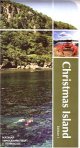
Christmas Island
NATMAP Topographic Map of Christmas Island 1:30 000 scale |
|
|
13.
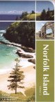
Norfolk Island
NATMAP Topographic Map of Norfolk Island 1:25 000 scale |
|
|
14.
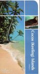
Cocos (Keeling) Islands
NATMAP Topographic Map of Cocos (Keeling) Islands 1:25 000 scale |
|

