|
1.
Cairns/Atherton Tablelands/Daintree 482
UBD; Size 690 x 1000mm |
|
|
2.
Cairns and Region
Hema |
|
|
3.
Cape York
Hema |
|
|
4.
Central Queensland
Hema |
|
|
5.
Fraser Island
Hema |
|
|
6.
Gladstone, Rockhampton and Surrounds 483/487
UBD Greg; |
|
|
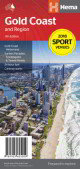
7.
Gold Coast and Region
Hema: Map of Gold coast: CBD, City, Suburbs & Hinterland
This map of the Gold Coast includes detailed mapping of the city (1:15,000) and suburbs (1:50,000), as well as a comprehensive overview of the surrounding Gold Coast Hinterland (1:100,000).
There?s plenty of useful visitor information marked on the mapping for staying in and getting around the Gold Coast, including fully updated roads, facilities and accommodation, as well as 2018 Commonwealth Games venues and temporary Park ?n? Ride locations. |
|
|
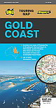
8.
Gold Coast 404
UBD/Gregory's; Size 690 x 920mm
Gold Coast region map at a scale of 1 : 160 000 covering along the coast from South Stradbroke Island in the north to Bogangar NSW in the south & Beaudesert in the west, Beenleigh in the north & Murwillumbah NSW in the south.
Region map at a scale of 1 : 450 000 covering along the coast from Sandgate in the north to Casuarina NSW in the south & Toowoomba & Warwick in the west, Fernvale in the north & Rathdowney in the south plus an index to towns.
Street level mapping at a scale of 1 : 25 000, 1 :18 000 & 1: 15 000 for Runaway Bay to Broadbeach, Mermaid Beach to Palm Beach, Currumbin to Tugun, Coolangatta Tweed Heads & Surfers Paradise. |
|
|
9.
Mackay and Whitsunday 485
UBD; Size 690 x 1000mm |
|
|
10.
Maryborough/Hervey Bay/ Bundaberg 486/480
UBD Gregorys; Size 575 x 1000mm |
|
|
11.
North Queensland
Hema |
|
|
12.
Outback Queensland
Hema |
|
|
13.
South East Queensland
Hema |
|
|
14.
South Eastern Queensland 431
UBD/Gregory's; Size 690 x 920mm |
|
|
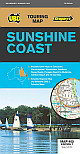
15.
Sunshine Coast 405
UBD Gregorys; Size 620 x 920mm
Sunshine Coast regional map at a scale of 1 : 171 950 & index covering along the coast from Inskip Peninsula in the north to Caloundra & Toorbul in the south, Wonga Lower in the west and Noosa Heads & Caloundra in the east.
Street level mapping at a scale of 1 : 25 000 with coverage for Caloundra & surrounding suburbs, Maroochydore Mooloolaba & surrounding suburbs, Nambour, Noosa Heads Noosaville Sunshine Beach, Peregian Beach to Mudjimba, Rainbow Beach & Tin Can Bay.
Visitor Information Centres Ideal for use when touring the Sunshine Coast |
|
|
16.
Toowoomba/Dalby/Kingaroy 488
UBD; Size 690 x 1000mm |
|
|
17.
Townsville & Cassowary Coast 489
UBD; Size 690 x 1000mm |
|

