|
1.
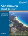
Shoalhaven Street Directory 9th Edition
Craigies; The Shoalhaven Street Directory is a Comprehensive Guide to the Streets and Roads within The City of Shoalhaven which extends from Berry & Kangaroo Valley in the North to Durras in the South.Including detailed Street Maps of Bangalee, Basin View, Bawley Point, Bendalong, Berrara, Berry, Bomaderry, Burrill Lake, Callala Bay, Callala Beach, Cambewarra Village, Cudmirrah, Culburra Beach, Cunjurong Point, Currarong, Durras North, Erowal Bay, Greenwell Point, Huskisson, Hyams Beach, Kangaroo Valley, Kioloa, Lake Conjola, Lake Tabourie, Manyana, Milton, Mollymook, Narrawallee, Nowra, Old Erowal Bay, Orient Point, St. Georges Basin, Sanctuary Point, Shoalhaven Heads, Sussex Inlet, Ulladulla, Vincentia & Worrigee. District Map Scale 1:110,000
Street Map Scale 1:26,000 |
|
|
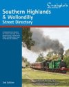
2.
Southern Highlands & Wollondilly Street Directory 2nd Edition
Craigies; The Southern Highlands & Wollondilly Street Directory is a Comprehensive Guide to the Streets and Roads within the Southern Highlands and Wollondilly Shires which extends from Warragamba and Silverdale in the North to Goulburn in the South and Crookwell in the WestIncluding detailed Street Maps of Alpine, Alymerton, Appin , Balmoral, Bargo, Berrima, Berrima Junction, Bowral, Bradfordville, Braemar, Brooklands, Bundanoon, Bungonia, Burradoo, Burrawang, Buxton, Colo Vale, Couridjah, Crestwood, Crookwell, Douglas Park, Eastgrove, Exeter, Fitzroy Falls, Garfield, Goulburn, Goulburn South, Hill Top, Ifield, Kenmore, Maldon, Marulan, Medway, Menangle, Mittagong, Moss Vale, Mowbray Park, Mt Hunter, North Goulburn, Oakdale, Penrose, Picton, Robertson, Run-O-Water, Silverdale, Sutton Forest, Tahmoor, Tallong, Tarago, The Oaks, Thirlmere, Warragamba, Welby, Wilton, Wingello, Yanderra, Yerrinbool. |
|
|
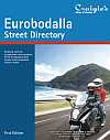
3.
Eurobodalla Street Directory 1st Edition
Craigies; The Eurobodalla Street Directory is a comprehensive guide to the streets and roads within the Eurobodalla Shire which extends from Durras in the north to Bermagui in the south.Including detailed street maps of Barling Beach, Batehaven , Batemans Bay, Bermagui, Bodalla, Broulee, Catalina, Central Tilba, Cobargo, Congo, Dalmeny, Denhams Beach, Durras, Durras Lake, Garlandtown, Guerilla Bay, Kianga, Lilli Pilli, Long Beach, Maloneys Beach, Malua Bay, Mogo, Moruya, Moruya Heads, Mossy Point, Mystery Bay, Narooma, Nelligen, North Narooma, North Rosedale, Potato Point, Rosedale, Sunshine Bay, Surfbeach, Surfside, The Anchorage, Tilba Tilba, Tomakin, Tuross Head |
|
|
| |
Your Basket
0 items in basket
|
|

