|
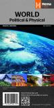
1.
World Political & Physical Pacific Centred
Hema |
|
|
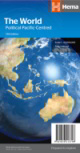
2.
World Political Pacific Centred
Hema |
|
|
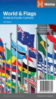
3.
World & Flags Pacific Centred
Hema |
|
|
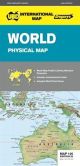
4.
World Physical 100
UBD Gregory's; 710 x 1010mm |
|
|
5.
World Political 160
UBD Greg; Size 690 x 1000mm
Detailed map of the World, Pacific Centered at a scale of 1: 40 754 000
Mercator projection
Comprehensive index with lists of Countries, National Capitals, State/Provincial names, State/Provincial Capitals, Dependency Territories, Deserts, Headlands, Island/Island Groups, Mountain/Mountain Ranges, Peninsulas, Regions, Oceans/Seas, Sounds, Straits, Bays, Ice Shelves, Reef, Lakes, Reservoirs and Rivers |
|
|
6.
Down Under Map of the World (folded) 161
Gregory's |
|
|
7.
Marco Polo World Map
Marco Polo; Marco Polo maps feature completely up-to-date, digitally generated mapping. Contains 7 self-adhesive Marco Polo mark-it stickers which can be used to pin-point a destination for future reference. Map Scale 1:32,000,000. |
|

|
8.
Michelin World Map
The World Michelin Map is perfect for route planning. It has excellent road detail and classification, and clear regions topography. Included in this map are national flags, population and surface areas and world time zones. The North Pole and the South Pole are shown as insets on this map. Main roads are well classified, as well as international boundaries, capitol and major cities as well as transcontinental railway systems. The map also features a reasonably comprehensive climate chart giving min and max temperatures and average monthly rainfall for major world cities. Also shown are mountains and ocean depths in certain areas. |
|
|
9.
Upside Down World in Envelope
Hema; This map is unlike any other! Traditional world maps are drawn from the perspective of the first European explorers and cartographers ? with the Northern Hemisphere at the top. We think it?s time to break with tradition and show the world from the perspective of all those people living in the Southern Hemisphere. The orientation is reversed from a standard North on top, South on bottom map. This time, the hemispheres are flip flopped and so are the continents, but still in a readable format (east coasts are west, and west coasts are east). This Pacific-centered map clearly shows all political boundaries and capital cities.Size; 840 x 594 mm. |
|
|
| |
Your Basket
0 items in basket
|
|

