|
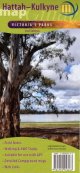
1.
Hattah-Kulkyne
Meridian; Scale 1:75,000, Field notes, Detail campground maps, Informative text, Only map of entire park, Double-sided with overlapping panel, Map size 594mm(W) x 420mm(H) flat |
|
|
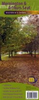
2.
Mornington & Arthurs Seat
Meridian; Scale 1:50,000, Two-Bays walking track, Mornington Peninsula National Park, Arthurs Seat State Park, Track notes to 13 walks, Double-sided with overlapping panel, Map size 594mm(W) x 420mm(H) flat |
|

|
3.
Lerdederg & Werribee Gorges
Meridian; 3rd Edition Nov 2005, Scale 1:35,000, Detailed enlargements, Suitable for use with GPS GDA 94 Datum, Informative text & field notes, Double-sided with overlapping panel, Map size 750mm(W) x 600mm(H) flat |
|
|
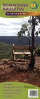
4.
Brisbane Ranges National Park
Meridian; 1st Edition Published August 2010, Scale 1:30,000, Detailed enlargements at 1:15,000. Suitable for use with GPS
GDA 94 Datum, Informative text & field notes. 750mm(W) x 600mm(H) flat |
|
|
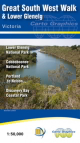
5.
Lower Glenelg and Discovery Bay Map
Meridian Maps and Carto Graphics. This new double sided, 1:50,000 scale topographic map, covers the Glenelg River from Dartmoor to Nelson and the river mouth and the complete Great South West Walk circling from Portland to Nelson and back again. |
|
|
| |
Your Basket
0 items in basket
|
|

