|
1.
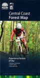
Central Coast Forest Map
The Central Coast Forest Map covers the central coast, Newcastle and Hunter regions. This includes the Watagans Mountains and Strickland State Forest near Gosford. The map shows all regularly maintained roads and trails, walking tracks, recreation areas and lookouts. The reverse side contains photographs and commentary on the history of the regions' forests and forestry in the area, and details of recreation sites, including the must-see sites and a recreation facilities matrix. This is a 'must have' for mountain bike riders, four-wheel-drive enthusiasts, bushwalkers, horseriders, dog owners and anyone who wants to explore the region's extensive public forest estate. |
|
|
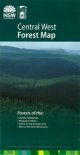
2.
Central West Forest Map
The Central West Forest Map covers the area west of the Blue Mountains, including the Central Tablelands, the Macquarie Valley, Bathurst, Orange and surrounds.The map shows all regularly maintained roads and trails, walking tracks, recreation areas and lookouts. The reverse side contains photographs and commentary on the history of the regions' forests and forestry in the area, and details of recreation sites, including the must-see sites and a recreation facilities matrix. This is a 'must have' for mountain bike riders, four-wheel-drive enthusiasts, bushwalkers, horseriders, dog owners and anyone who wants to explore the region's extensive public forest estate. |
|
|
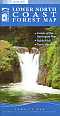
3.
Lower North Coast Forest Map
The Lower North Coast Forest Map covers the Barrington Tops, Bulahdelah and Taree/Manning areas. The map shows all regularly maintained roads and trails, walking tracks, recreation areas and lookouts. The reverse side contains photographs and commentary on the history of the regions' forests and forestry in the area, and details of recreation sites, including the must-see sites and a recreation facilities matrix. This is a 'must have' for mountain bike riders, four-wheel-drive enthusiasts, bushwalkers, horseriders, dog owners and anyone who wants to explore the region's extensive public forest estate. |
|
|
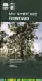
4.
Mid North Coast Forest Map
The Mid North Coast Forest Map covers the areas around Kempsey, Wauchope, Port Macquarie and Walcha. The map shows all regularly maintained roads and trails, walking tracks, recreation areas and lookouts. The reverse side contains photographs and commentary on the history of the regions' forests and forestry in the area, and details of recreation sites, including the must-see sites and a recreation facilities matrix. This is a 'must have' for mountain bike riders, four-wheel-drive enthusiasts, bushwalkers, horseriders, dog owners and anyone who wants to explore the region's extensive public forest estate. |
|
|
5.
South Coast Forest Map
The South Coast Forest Map covers the area from Nowra south to Cobargo and west to Queanbeyan. The map shows all regularly maintained roads and trails, walking tracks, recreation areas and lookouts. The reverse side contains photographs and commentary on the history of the regions' forests and forestry in the area, and details of recreation sites, including the must-see sites and a recreation facilities matrix. This is a 'must have' for mountain bike riders, four-wheel-drive enthusiasts, bushwalkers, horseriders, dog owners and anyone who wants to explore the region's extensive public forest estate. |
|
|
6.
Far South Coast Map
Map of far South Coast forest in New South Wales showing state forest, national parks, state conservation area, preserved forest area, leasehold land within state forest, virtually freehold land, vacant and reserved crown land, leasehold crown land, built up area, declared wilderness, private softwood planation, joint venture softwood plantation, private hardwood plantation, roads and tracks. |
|
|
7.
Tracking through the South East Forests of NSW - Bushwalking
This book includes desctiptions of New South Wales south-east's National Parks, including their rich natural and cultural history; detailed maps showing park facilities; Drivers' Guide - describing 5 unique 2WD and 4WD tours; Walkers' Guide - describing 20 selected walks of all grades; and a Campgound listing with full details of each campground. |
|
|
8.
Central Murray Valley
|
|
|
| |
Your Basket
0 items in basket
|
|

