|
1.
Bathurst/Dubbo/Orange 282
UBD; Size 695 x 1000mm |
|
|
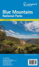
2.
Blue Mountains National Parks
Craigies; Blue Mountains National Park Map covers the Blue Mountains, Kanangra-Boyd and Abercrombie River National Parks extending from Lidsdale in the north to Wombeyan Caves and Bargo in the south.
This very detailed map includes road, highways, road shields, suburbs and towns. Wilderness, forest and water catchment boundaries are also marked along with a handy grid for the 1:25 000 NSW topographic map coverage.
A very useful map for a complete overview of the Blue Mountains region it allows visitors to plan their journeys, with many fire trails and walking routes noted. The reverse side features detailed town maps of Blue Mountains townships including Blackheath, Medlow Bath, Katoomba, Leura, Wentworth Falls, BullaburraHazelbrook, Woodford, Faulconbridge, Springwood, Valley Heights, Warrimoo, Blaxland, Glenbrook, Mount Riverview and Lapstone.
Also included are mud maps for Blackheath, Katoomba, Leura and Wentworth Falls walking tracks noting lookouts, walking times and track grades.
National Parks Map Scale 1:130,000
Size (unfolded) 700 x 1000mm 1000 x 690mm |
|
|
3.
Blue Mountains 290
UBD; 1000 x 690mm |
|
|
4.
Central Coast (NSW) Suburban Streets 289
UBD/Gregory's 289 12th 710 x 1010mm |
|
|
5.
Coffs Coast & Port Macquarie 278/294
UBD/Gregory's278/294 |
|
|
6.
Far North Coast NSW 296
UBD/Greg; Size 690 x 1000mm |
|
|
7.
Hunter Valley 213
UBD/Gregory's; Size 690 x 920mm |
|
|
8.
Newcastle Suburban Streets 280
UBD/Gregory's; 280 Size 710 x 1010mm |
|
|
9.
North East New South Wales
Hema |
|
|
10.
Outback New South Wales
Hema |
|
|
11.
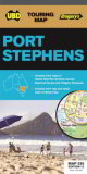
Port Stephens 295
UBD; A Regional touring map covering Port Stephens, Hawks Nest/Tea Gardens, Karuah, Lemon Tree Passage and Raymond Terrace.
Maps and street index of Nelson Bay and surrounding suburbs. Maps of Hawks Nest/Tea Gardens, Karuah, Raymond Terrace and Tilligerry Peninsula (Lemon Tree Passage, Mallabula, Tanilba Bay)
Size 920 x 500mm |
|
|
12.
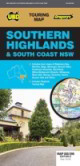
Southern Highlands & South Coast NSW 283/298
UBD Gregory's: Size 690 x 1000mm
Regional touring map covering the coast from Shellharbour in the north to Eden in the south and west to Goulburn and Braidwood; Maps and street indexes of Batemans Bay, Mogo, Milton, Mollymook, Ulladulla and Nowra, and town maps of Bega, Berrima, Bowral, Eden, Huskisson, Vincentia, Merimbula, Mittagong, Moruya, Moss Vale, Narooma, Sussex Inlet and Tathra; Regional touring attractions and advertisers index; Safe driving tips and safety tips from the SES. |
|
|
13.
Wagga Wagga & The Riverina 284
UBD |
|
|
14.
Wollongong Suburban Streets 299
UBD/Gregory's; Map 299 Size 690 x 1000mm
Street level mapping and street index at a scale of 1 : 25 000 from Helensburgh in the north to Dunmore in the south. Coverage included for Berry & Nowra, North Nowra & Bomaderry
Index to suburbs & localities
Overview map of Wollongong to Nowra at a scale of 1 : 685 700 |
|
|
15.
Merimbula - Bermagui; Rooftop
Rooftop, 1:100,000 |
|
|
16.
Mt Kosciuszko Northern, Kiandra, Tumut; Rooftop
Rooftop; Size: 1050 x 750 mm Scale 1:50 000 An activities map that is ideal for bushwalking from Kiandra to Tumut. Perfect detail for walking |
|
|
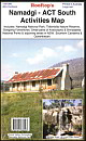
17.
Namadgi ACT South Activities Map; Rooftop
Rooftop, 1:50,000
Coverage includes Namadgi National Park, Tidbinbilla Nature Reserve, Googong Foreshores, small sections of Kosciuszko and Brindabella National Parks & adjoining areas in New South Wales, Southern Canberra and Queanbeyan. |
|
|
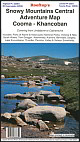
18.
Snowy Mtns Central - Cooma to Khancoban; Rooftop
Rooftop, 1:100,000 |
|
|
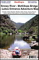
19.
Snowy River - McKillops Bridge - Lakes Entrance; Rooftop
Rooftop - Victoria, Scale 1:100,000 |
|
|
| |
Your Basket
0 items in basket
|
|

