|
1.
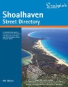
Shoalhaven Street Directory 9th Edition
Craigies; The Shoalhaven Street Directory is a comprehensive guide to the streets and roads within the City of Shoalhaven which extends from Berry & Kangaroo Valley in the north to Durras in the south.Including detailed street maps of Bangalee, Basin View, Bawley Point, Bendalong, Berrara, Berry, Bomaderry, Burrill Lake, Callala Bay, Callala Beach, Cambewarra Village, Cudmirrah, Culburra Beach, Cunjurong Point, Currarong, Durras North, Erowal Bay, Greenwell Point, Huskisson, Hyams Beach, Kangaroo Valley, Kioloa, Lake Conjola, Lake Tabourie, Manyana, Milton, Mollymook, Narrawallee, Nowra, Old Erowal Bay, Orient Point, St. Georges Basin, Sanctuary Point, Shoalhaven Heads, Sussex Inlet, Ulladulla, Vincentia & Worrigee. District Map Scale 1:110,000
Street Map Scale 1:26,000 |
|
|
2.
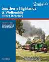
Southern Highlands & Wollondilly Street Directory 2nd Edition
Craigies; The Southern Highlands & Wollondilly Street Directory is a Comprehensive Guide to the Streets and Roads within the Southern Highlands and Wollondilly Shires which extends from Warragamba and Silverdale in the North to Goulburn in the South and Crookwell in the WestIncluding detailed Street Maps of Alpine, Alymerton, Appin , Balmoral, Bargo, Berrima, Berrima Junction, Bowral, Bradfordville, Braemar, Brooklands, Bundanoon, Bungonia, Burradoo, Burrawang, Buxton, Colo Vale, Couridjah, Crestwood, Crookwell, Douglas Park, Eastgrove, Exeter, Fitzroy Falls, Garfield, Goulburn, Goulburn South, Hill Top, Ifield, Kenmore, Maldon, Marulan, Medway, Menangle, Mittagong, Moss Vale, Mowbray Park, Mt Hunter, North Goulburn, Oakdale, Penrose, Picton, Robertson, Run-O-Water, Silverdale, Sutton Forest, Tahmoor, Tallong, Tarago, The Oaks, Thirlmere, Warragamba, Welby, Wilton, Wingello, Yanderra, Yerrinbool. |
|
|
3.
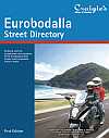
Eurobodalla Street Directory 1st Edition
Craigies; The Eurobodalla Street Directory is a comprehensive guide to the streets and roads within the Eurobodalla Shire which extends from Durras in the north to Bermagui in the south.Including detailed street maps of Barling Beach, Batehaven , Batemans Bay, Bermagui, Bodalla, Broulee, Catalina, Central Tilba, Cobargo, Congo, Dalmeny, Denhams Beach, Durras, Durras Lake, Garlandtown, Guerilla Bay, Kianga, Lilli Pilli, Long Beach, Maloneys Beach, Malua Bay, Mogo, Moruya, Moruya Heads, Mossy Point, Mystery Bay, Narooma, Nelligen, North Narooma, North Rosedale, Potato Point, Rosedale, Sunshine Bay, Surfbeach, Surfside, The Anchorage, Tilba Tilba, Tomakin, Tuross Head |
|
|
4.
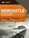
Newcastle, Central Coast and the Hunter
UBD; CENTRAL COAST DIRECTORY FEATURES: Revised and updated with over 60 new streets. Includes fixed speed camera locations. Detailed maps of Gosford, Terrigal, The Entrance, Woy Woy and Wyong centres. Comprehensive facilities listing includes parks and reserves, nursing homes, theatres, caravan parks, schools, swimming pools and boat ramps. Developments included for Hamlyn Terrace, Morisset Park, Wadalba, Woongarrah and Wyong
NEWCASTLE DIRECTORY FEATURES: Revised and updated with over 270 new streets. Includes red light and fixed speed camera locations. Includes new suburbs of Murrays Beach and Pinny Beach. Major Subdivisions at Cameron Park, Fern Bay, Fletcher, Gillieston Heights, Morisset Park and Tanilba Bay. Extended mapping to include the Lower Hunter Valley Wineries region. Show's Australia's largest new industrial business estate: The Hunter Economic Zone. Location of proposed F3 extension (Black Hill to Raymond Terrace) |
|
|
5.
Newcastle Compact 1st
UBD Greg; From Nelson Bay to Catherine Hill Bay
With town maps, regional road maps, touring information, places of interest, events guide, accommodation and lots more. Includes Maitland, Cessnock, Morisset, Wallsend, Belmont, Swansea, Raymond Terrace |
|
|
6.
New South Wales
UBD Greg; With its modernised and simplified layout, the 19th edition of the New South Wales Street Directory is easier to use than ever!
Your ideal companion to travelling around New South Wales, the new edition has over 130 updated town maps covering from Tweed Heads to Eden, from Broken Hill to Port Macquarie |
|
|
7.
City Link
UBD; Updated, extended street directory coverage of the six key regions in the greater Sydney area including Sydney, the Blue Mountains, Canberra, the Central Coast, Newcastle and Wollongong. Shows red light locations. Fixed speed camera sites shown. New suburbs shown: Freshwater (formerly Harbord), Caringbah South and Barangaroo in Sydney; Extended coverage of Nowra and Ulladulla on the South Coast; New suburbs of Crestwood, Queanbeyan East and West in the Canberra district. New subdivisions in all regions shown: The Ponds Rouse Hill and Wilton in Sydney; Hamlyn Terrace, Magenta Shores, Wadalba, Woongarrah and Wyong on the Central Coast; Major subdivisions at Cameron Park, Fern Bay, Fletcher, Gillieston Heights, Morriset Park and Tanilba Bay in the expanding Newcastle region. |
|
|
8.
Sydney & Blue Mountains including Truckies
UBD; Revised and updated with over 850 new street listings. New enlarged maps of Blacktown, Burwood, Castle Hill, Cronulla, Hornsby, Manly, Mount Druitt, Penrith, Ryde, Strathfield and West along Parramatta Road. New suburbs include The Ponds and Constitution Hill. Detailed mapping of the North-West transit way and the Lane Cove Tunnel. Includes Red Light and Fixed Speed Camera Locations. Westlink M7 mapping included. Includes flood evacuation routes. No right hand turns shown in the CBD. |
|
|
9.
Sydney & Blue Mountains 50th Anniversary edition
UBD; |
|
|
10.
Sydney Compact
UBD/Gregorys; A conveniently sized street directory ideal for the glovebox, car door or seat pocket, backpack, briefcase or even under a motorbike seat. features a detailed city business district maps and shows over 9,000 facilities, including Caravan Parks, Golf Courses, Hotels & Motels, Places of Interest, Racecourse & Theatres. |
|
|
11.
Wollongong, South coast & Southern Highlands
UBD Greg; Over 1,650 Facilities including Aged Care Facilities, Caravan Parks, Hotels & Motels, Places of Interest, Swimming Pools & theatres; 59 maps covering the Wollongong & surrounds areas of Kiama, Berry, Nowra& Shoalhaven Heads; 21 Regional Town Maps, including Batemans Bay, Berrima, Bowral, Huskisson, Moss Vale, Sussex Inlet, Tathra & Ulladulla; Wollongong City Centre Map; Special map of Wollongong University |
|
|
| |
Your Basket
0 items in basket
|
|

