|
1.
Albury/Wodonga 381
UBD; Size 690 x 1000mm |
|
|
2.
Ballarat/Grampians & Spa Country 382
UBD; Size 575 x 1000mm |
|
|
3.
Bendigo/Shepparton 383
UBD; Size 690 x 1000mm |
|
|
4.
Gippsland Discovery & Wilsons Promontory 386
UBD Greg; Size 690 x 1000mm |
|
|
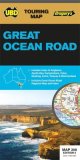
5.
Great Ocean Road 308
UBD Gregory's; Size 575 x 920mm |
|
|
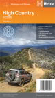
6.
High Country - Victoria
Hema |
|
|
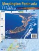
7.
Mornington Peninsula Info Map
Meridian |
|
|
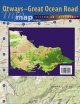
8.
Otways-Great Ocean Road Info Map
Meridian |
|
|
9.
Victoria's High Country 307
Gregory's 309 Size 690 x 920mm |
|
|
10.
Bairnsdale - Dargo - Omeo; Rooftop
Rooftop - Victoria, Scale 1:100,000 |
|
|
11.
Barmah - Shepparton - Deniliquin; Rooftop
Rooftop - Victoria, Scale 1:100,000 |
|
|
12.
Beechworth - Albury - Wangaratta; Rooftop
Rooftop - Victoria, Scale 1:100,000 |
|
|
13.
Benalla - Mansfield; Rooftop
Rooftop - Victoria, Scale 1:100,000 |
|
|
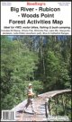
14.
Big River - Rubicon - Woods Point; Rooftop
Rooftop: Size: 680 x 900 mm A forest activities map that has mapping at both 1:50,000 and 1:100,000 that covers as far as Mt Skene. Places of interest, Ideal for outdoor recreational activities |
|
|
15.
Bright - Mansfield; Rooftop
Rooftop - Victoria, Scale Various |
|
|
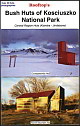
16.
Bush Huts of Kosciuszko National Park; Rooftop
Rooftop: Size: 290 x 1010 mm A map that features the 39 of the central region huts between Kiandra and Jindabyne in Kosciuszko National Park. |
|
|
17.
Cann River - Orbost - Delegate - Bendoc; Rooftop
Rooftop - Victoria, Scale Various |
|
|
18.
Cathedral Range Pocket; Rooftop
Rooftop; Size: 325 x 410 mm A pocket map that covers from Buxton to Taggerty at a highly detailed scale of 1:30,000. Coverage includes most of Cathedral Range State Park; Field-checked walking tracks; A selection of easy and hard walks |
|
|
19.
Cohuna - Echuca ? Gunbower; Rooftop
Rooftop: Size: 705 x 1015 mm A forest activities map that has mapping at both 1:50,000 and 1:100,000 that covers from Cohuna to Gunbower. Places of interest, Ideal for outdoor recreational activities |
|
|
20.
Corroyong - Omeo - Thredbo; Rooftop
Rooftop - Victoria, Scale 1:100,000 |
|
|
21.
Dargo - Wonnangatta; Rooftop
Rooftop - Victoria, Scale 1:100,000 |
|
|
22.
Daylesford - Castlemaine ? Ballarat; Rooftop
Rooftop: Size: 700 x 1015 mm A forest activities map that has mapping at both 1:50,000 and 1:100,000 that covers Central Victoria. Places of interest, Ideal for outdoor recreational activities |
|
|
23.
Gembrook ? Powelltown; Rooftop
Rooftop: Size: 700 x 330 mm Scale 1:40 000A forest activities map that has mapping at 1:50,000 that covers Bunyip State Park and Kurth Kiln Park. Places of interest, Ideal for outdoor recreational activities |
|
|
24.
Gippsland Lakes - Ninety Mile Beach; Rooftop
Rooftop - Victoria, Scale 1:100,000 |
|
|
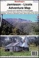
25.
Jamieson - Licola; Rooftop
Rooftop - Victoria, Scale 1:100,000 |
|
|
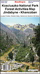
26.
Kosciuszko National Park, Jindabyne, Khancoban; Rooftop
Rooftop; Size: 1010 x 700 mm A forest activities map at a scale of 1:50,000 that covers the Kosciuszko National Park. Places of interest, Ideal for outdoor recreational activities |
|
|
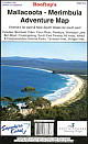
27.
Mallacoota - Merimbula; Rooftop
Rooftop - Victoria, Scale 1:100,000 |
|
|
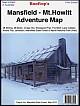
28.
Mansfield - Mt Howitt; Rooftop
Rooftop - Victoria, Scale 1:100,000 |
|
|
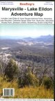
29.
Marysville - Lake Eildon; Rooftop
Rooftop - Victoria, Scale 1:100,000 |
|
|
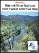
30.
Mitchell River National Park; Rooftop
Rooftop; Size: 300 x 500 mm A forest activities map at a scale of 1:50,000 that covers the Mitchell River National Park. Places of interest, Ideal for outdoor recreational activities |
|

|
31.
Mt Buffalo Plateau; Rooftop
Rooftop: Size: 700 x 355 mm A forest activities map that has mapping at 1:50,000 that covers from Bright to Mount Buffalo. Places of interest, Ideal for outdoor recreational activities |
|
|
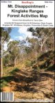
32.
Mt Disappointment - Kinglake Ranges; Rooftop
Rooftop; A forest activities map that has mapping at 1:50,000 that features Mount Disappointment and Kinglake National Park. Places of interest, Ideal for outdoor recreational activities |
|
|
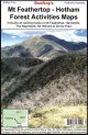
33.
Mt Feathertop ? Hotham; Rooftop
Rooftop; Size: 430 x 700 mm Scale 30 000. A forest activities map that has mapping at 1:50,000 that covers Mount Feathertop and Mt Hotham that is ideal for bushwalking. Places of interest, Ideal for outdoor recreational activities |
|
|
34.
South Gippsland - Wilsons Promontory; Rooftop
Rooftop - Victoria, Scale 1:100,000 |
|
|
35.
Tallarook; Rooftop
Rooftop; Size: 365 x 490 mm A forest activities map at a scale of 1:50,000 that features the Tallarook State Forest. Places of interest, Ideal for outdoor recreational activities |
|
|
36.
Toolangi - Black Range; Rooftop
Rooftop; Size: 700 x 585 mm A forest activities map at a scale of 1:50,000 that covers between Maroondah and Melba Highways. Places of interest, Ideal for outdoor recreational activities |
|
|
37.
Toolangi - Macedon; Rooftop
Rooftop - Victoria, Scale 1:100,000 |
|
|
38.
Upper Murray; Rooftop
Rooftop - Victoria, Scale 1:100,000 |
|
|
39.
Walhalla - Woods Point; Rooftop
Rooftop - Victoria, Scale 1:100,000 |
|
|
40.
Wonnangatta Approaches; Rooftop
Rooftop; Size: 655 x 710 mm A forest activities map at a scale of 1:50,000 that features the Wonnangatta Valley. Places of interest, Ideal for outdoor recreational activities. |
|
|
41.
Yarra Valley - West Gippsland; Rooftop
Rooftop - Victoria, Scale 1:100,000 |
|

