Home Page    |   Contact Us   
   Custom Mapping Specialists    |    Awards    |    Online Shopping    |    Promotional Map Products   
Home
About Cartodraft

ONLINE SHOPPING

Browse online shop

- Street Directory -ACT
- Street Directory -NSW
- Street Directory -NT
- Street Directory -QLD
- Street Directory -SA
- Street Directory -VIC
- Street Directory -WA

Delivery and Order Information

CRAIGIES MAPS

- Visitors Maps
- Touring Maps
- State Maps
- Street Directories
- Laminated Maps

WALL MAPS

- Laminated

EDUCATIONAL WALL MAPS

- World Political
- Australia and its Neighbours
- Australia Political
- Australia Physical
- New South Wales

POSTCODE MAPS

- Postcode Maps

CUSTOM MAPPING

- Custom Mapping Services
- Showcase

MAP ENLARGEMENTS

- Mapping Enlargements

WEBSITE MAPPING

- Maps for websites
- Showcase

LAMINATING SERVICE

- Lamination Services

PRINTING SERVICE

- Printing Services

DIGITAL MAPS

- International
- Australian
- New Zealand

GPS

- Hema Navigator

GROOVY MAPS

- Maps & Guides

SATELLITE MAPS AND POSTERS

- Satellite Maps and Posters

TOPOGRAPHIC MAPS

- NSW Lands
- NATMAP 1:50,000
- NATMAP 1:100,000
- NATMAP 1:250,000
- National
- NATMAP PNG
- Raster CD & DVD

MAP AND PLAN MEASURING TOOLS

- Scalex Map Wheel™
- Scalex Plan Wheel™

CARTOGRAPHY BOOKS

- Getting there from Here
- The States of a Nation

PROMOTIONAL PRODUCTS

- Desk Pads, Courtesy maps and more

CD AND DVD PRODUCTS

- Digital Street Directories
- Postcodes Australia and DVD Products
- Topographic Maps and DVD Products
- CD Maps

INTERNATIONAL MAPS

- Countries/Regions A-D
- Countries/Regions E-H
- Countries/Regions I-L
- Countries/Regions M-P
- Countries/Regions S-U
- Groovy Map 'n Guide

STREET DIRECTORIES

- Street Directory -ACT
- Street Directory -NSW
- Street Directory -NT
- Street Directory -QLD
- Street Directory -SA
- Street Directory -VIC
- Street Directory -WA
- Street Directory -NZ

ATLASES AND GUIDES

- Road Atlases
- Touring & Recreational Guides

TOURING MAPS

- City to City Touring Maps

WORLD MAPS

- World Maps

AUSTRALIAN MAPS

- Australian Maps

FORESTRY MAPS

- Forestry Maps - NSW

NATIONAL PARK MAPS

- National Park Maps - NSW
- National Park Maps - Vic
- National Park Maps - Qld
- National Park Maps - Tas

4WD MAPS & GUIDES

- Great Desert Track Series
- 4 Wheel Driving Maps
- 4 Wheel Driving Guides
- 4 Wheel Driving CD's

CITY MAPS

- Major Cities A-B
- Major Cities C-L
- Major Cities M-P
- Major Cities S-Z
- Regional Cities

REGIONAL MAPS

- Regional Maps -NSW
- Regional Maps -NT
- Regional Maps -QLD
- Regional Maps -SA
- Regional Maps -VIC
- Regional Maps -WA
- Regional Maps -TAS

STATE MAPS

- State Maps -NSW
- State Maps -NT
- State Maps -Queensland
- State Maps -SA
- State Maps -Victoria
- State Maps -WA
- State Maps -Tasmania

NEW ZEALAND MAPS

- New Zealand - Atlases
- New Zealand - Maps
- New Zealand - City Maps
- New Zealand - Street Directories
- New Zealand - Regional Maps
- New Zealand - Laminated Maps
Awards
Links
Terms and conditions
Privacy Policy
Information Request/Contact

Street Directory -WA


3 steps to ordering maps from Cartodraft:
  • Enter quantity required next to Qty.
  • Click on the Buy button. Add more products by clicking Continue Shopping button
  • To complete your purchase, click on CHECKOUT button.

Perth   1. Perth

UBD/Gregory's; Revised and updated with 1000 new streets. New suburbs include Aveley and Cockburn Central. Red light camera locations shown. Facilities index includes bays and beaches, hotels and motels, caravan, tourist and mobile homes, major shopping complexes, theatres & cinemas and much more. Major Universities updated. Includes new Perth - Bunbury Highway. Main Road Maps. Fully revised facilities index. New Port Coogee Marina development
SD027 $44.99 ea   Qty

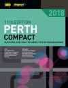
Perth Compact   2. Perth Compact

UBD; A comprehensive street directory covering Perth, Fremantle and surrounding suburbs. Convenient size: 190mm (h) x 122m (w) - ideal for the glovebox, door or seat pocket, backpack, handbag, briefcase and even under a motorbike seat. Revised cityside guide with information on city sights, shopping and markets, culture and entertainment, restaurants and cafes, bars, clubs and pubs, backpacker accommodation and public transport information. Comprehensive suburb and postcode listings. Contains special map for the University of Notre Dame. Petrol station locations now shown on the maps. Fully revised facilities including locations of airports, caravan, tourist and mobile home parks, hospitals, parks and sporting venues, theatres and much more
SD031 $29.99 ea   Qty

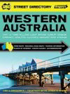
Western Australia Street Directory   3. Western Australia Street Directory

UBD; Maps for more than 140 regional cities and towns shown in alphabetical order. Detailed maps of Perth. 35 road atlas maps of Western Australia. Includes touring information and an updated local accommodation guide on all the Western Australian tourism regions. Includes places of interest, facilities, accommodation and events for each town. Western Australian keymap. National parks chart and distance chart.
RAG020 $34.99 ea   Qty

Your Basket

0 items in basket


   Copyright Cartodraft P/L 2001-2019   Online map store Contact Cartodraft