|
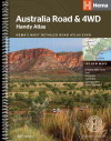
1.
Australia Road and 4WD Handy Atlas Spiral
Hema; Spiral bound: Size 184 x 248mm
Featuring trusted Hema mapping for all of Australia, the Hema Road & 4WD Handy Atlas is the definitive travel guide for tourers and adventurers. Hema atlases feature more information useful to travellers, including 4WD tracks, campsites, caravan parks, rest areas, 24-hour fuel and points of interest.
The new edition contains more mapping than ever before, which is enhanced by a striking new cartographic style that?s incredibly easy to read. Included in this is up-to-date mapping for Australia?s biggest 4WD destinations: Cape York, Fraser Island, the Top End, the Kimberley, the Pilbara, Central Australia, High Country Victoria and the Flinders Ranges.
A handy distance grid, national park guide, list of accredited information centres and a complete index are also included to assist with trip planning and navigation, making it the perfect tool for guiding tourers, campers, road trippers and off-roaders throughout Australia. |
|
|
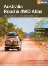
2.
Australia Road and 4WD Atlas
Hema; B4 Size 252 x 345mm. Perfect Bound.
Featuring trusted Hema mapping for all of Australia, the Hema Road & 4WD Easy Read Atlas is the definitive travel guide for tourers and adventurers. Hema atlases feature more information useful to travellers, including 4WD tracks, campsites, caravan parks, rest areas, 24-hour fuel and points of interest.
The new edition contains more mapping than ever before, which is enhanced by a striking new cartographic style that?s incredibly easy to read. Included in this is up-to-date mapping for Australia?s biggest 4WD destinations: Cape York, Fraser Island, the Top End, the Kimberley, the Pilbara, Central Australia, High Country Victoria and the Flinders Ranges.
A handy distance grid, national park guide, list of accredited information centres and a complete index are also included to assist with trip planning and navigation, making it the perfect tool for guiding tourers, campers, road trippers and off-roaders throughout Australia. |
|
|
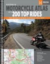
3.
Australia Motorcycle Atlas
Hema; Split into two books, volume 1 contains the 200 Top Rides while volume 2 is Hema's best-selling road atlas, with the dynamic duo being complemented by a custom 'Great Motorcycle Rides of Australia' wall map. Coming with a handy magnifier as well, everything included in the Australia Motorcycle Atlas +200 Top Rides is packaged snugly into a durable plastic sleeve which is perfect for travel. |
|
|
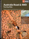
4.
Australia Road and 4WD Touring Atlas A4
Hema; A4 Size 210 x 297mm. Spiral Bound.
Featuring trusted Hema mapping for all of Australia, the Hema Road & 4WD Easy Read Atlas is the definitive travel guide for tourers and adventurers. Hema atlases feature more information useful to travellers, including 4WD tracks, campsites, caravan parks, rest areas, 24-hour fuel and points of interest.
The new edition contains more mapping than ever before, which is enhanced by a striking new cartographic style that?s incredibly easy to read. Included in this is up-to-date mapping for Australia?s biggest 4WD destinations: Cape York, Fraser Island, the Top End, the Kimberley, the Pilbara, Central Australia, High Country Victoria and the Flinders Ranges.
A handy distance grid, national park guide, list of accredited information centres and a complete index are also included to assist with trip planning and navigation, making it the perfect tool for guiding tourers, campers, road trippers and off-roaders throughout Australia. |
|
|
5.
Australia Truckies Atlas Hema
Hema; The Australia Truckies Atlas is the complete Hema Road Atlas with additional truck-related features like Triple trains, B-Double and Road Train Routes. Also including higher mass limit routes, Western Australia's new Networks, 10 new map pages and a plastic pocket in the back for any loose paper work or dockets. There's also plenty of advice on permits, limits and load safety plus a complete dealer listing. |
|
|
6.
Australia Road + 4WD Atlas Spiral B4
Hema; B4 Size 252 x 345mm. Spiral Bound.
Featuring trusted Hema mapping for all of Australia, the Hema Road & 4WD Easy Read Atlas is the definitive travel guide for tourers and adventurers. Hema atlases feature more information useful to travellers, including 4WD tracks, campsites, caravan parks, rest areas, 24-hour fuel and points of interest.
The new edition contains more mapping than ever before, which is enhanced by a striking new cartographic style that?s incredibly easy to read. Included in this is up-to-date mapping for Australia?s biggest 4WD destinations: Cape York, Fraser Island, the Top End, the Kimberley, the Pilbara, Central Australia, High Country Victoria and the Flinders Ranges.
A handy distance grid, national park guide, list of accredited information centres and a complete index are also included to assist with trip planning and navigation, making it the perfect tool for guiding tourers, campers, road trippers and off-roaders throughout Australia. |
|
|
7.
Australia Road and 4WD Easy Read Atlas
Hema; Spiral bound, 292 x 397mm.
Featuring trusted Hema mapping for all of Australia, the Hema Road & 4WD Easy Read Atlas is the definitive travel guide for tourers and adventurers. Hema atlases feature more information useful to travellers, including 4WD tracks, campsites, caravan parks, rest areas, 24-hour fuel and points of interest.
The new edition contains more mapping than ever before, which is enhanced by a striking new cartographic style that?s incredibly easy to read. Included in this is up-to-date mapping for Australia?s biggest 4WD destinations: Cape York, Fraser Island, the Top End, the Kimberley, the Pilbara, Central Australia, High Country Victoria and the Flinders Ranges.
A handy distance grid, national park guide, list of accredited information centres and a complete index are also included to assist with trip planning and navigation, making it the perfect tool for guiding tourers, campers, road trippers and off-roaders throughout Australia. |
|
|
8.
Explore Australia
Explore Australia: This continues to be the best-value travel guide and atlas on the market, and is an invaluable travel bible for anyone planning an extended holiday in Australia. Explore Australia covers over 700 towns in detail and each of the country's capital cities. There's also an overview of the 'must sees' and 'must dos' for each holiday region in Australia. In addition, this trusted guidebook includes the population for every major town across the country, selected food and accommodation listings, a comprehensive atlas as well as detailed maps for key tourist towns. An overview of Australia outlining the country's history, flora and fauna completes the package |
|
|
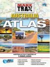
9.
Make Trax Australia Atlas
Westprint: This new Make Trax Australia Atlas features highly detailed Westprint maps for the whole of Australia. The maps are all at 1:950,000 scale giving the highest level of detail of any atlas for the outback regions of Australia. It also means that each page is at exactly the same scale. |
|
|
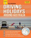
10.
Driving Holidays Around Australia
Explore Australia: A driving holiday is one of the best ways to see Australia, from a short weekend getaway to an extended road trip through the outback. Lee Atkinson has selected out the top 40 road trips around the country and clearly sets out detailed touring information for each trail. There is information on the best time to travel, itinerary options, attractions in towns, national parks, potential side trips, food and accommodation listings, maps and a ?kids spot? for family road trippers. With spiral-binding for easy in-car use, this guidebook will make sure you don?t miss any of the best places on a driving holiday around this great brown land. |
|
|
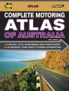
11.
Complete Motoring Atlas of Australia
UBD; Touring Australia is made easier with this comprehensive Motoring Atlas - an invaluable companion for both planning a holiday and driving. Fabulous full colour maps iwth essential touring information make this Atlas a vital component in every car. 105 pages of full colour digital mapping. New and updated digital mapping of all capital cities, states and territories. State, city and Australia wide touring information. Australia wide national parks charts. 16 route maps showing how to get from one city to another in the easiest way possible. Information on outback motoring, trip preparation and what to do in an accident. Detailed Distance Chart. Major highways and travelling times map |
|
|
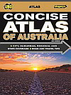
12.
Concise Atlas of Australia
UBD; This altas is an invaluable companion for both planning your holiday as well as for tourists travelling around Australia. The handy compact size allows for easy storage in your glove box. Features include: Comprehensive state by state mapping, Maps of all capital city centres, 25 detailed capital city suburban maps, Attractively designed presentation, Each state divided by colour for ease of use, Extensive distance chart, National Parks Chart, Australian Route Maps, Detailed Index, Useful for planning trips away |
|
|
13.
Road Atlas of Australia
Gregory's; Comprehensive maps and touring information on 48 tourist regions, including; The Hunter Valley, The Great Ocean Road, Sunshine Coast, Barossa Valley, Bunbury, Uluru and the Tasman Peninsula
New accurate digital mapping of all states and territories, capital cities and major tourist regions
Useful information on first aid, planning your trip and motoring survival, Interesting facts and lists of major attractions for each capital city and tourist region, Extensive distance charts, Over 140 colour photographs, Comprehensive index |
|
|
14.
Truckies Motoring Atlas of Australia
UBD; This may not be the only truckies atlas available on the market, but it?s the only atlas that?s been made from scratch especially for truckies. Map features: - All maps specially designed for this product by Universal Publishers? and Explore Australia?s expert cartographers. - Low clearance warnings/indicators with height are shown at better scales. - Maps show roadside heavy-vehicle parking bays and rest areas, public weighbridges, designated petrol company truck stops, petrol stations offering diesel, over 400 mines and the main ports around Australia. -State overviews, capital city CBD and extended metropolitan coverage with clear maps covering greater metro areas. -Over 100 town maps for selected regional centres. -Strip maps for major highways. |
|
|
15.
Touring Atlas of Australia
UBD Gregory's; Paperback
Easy-to-use, large-scale maps; Inter-city route maps with detailed town descriptions, including visitor centre details and nearby attractions. Over 1000 recommended rest areas located along Australia?s major highways, broken into the following categories:
*Camp area, fee applies
*Rest area with free camping
*Rest area only
*Camp area with toilet, fee applies *Rest area with free camping and toilet
*Rest area only with toilet;
Comprehensive index |
|
|
| |
Your Basket
0 items in basket
|
|

