|
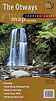
1.
Otways - 4WD Map
Meridian; Boundary and naming changes to the Great Otway National Park and Otways Forest Park
* Inclusion of the recently opened Great Ocean Walk and all facilities
* Completed Old Beechy Rail Trail
* Updated camping and facilities
* Single sided for a greater view of the whole region |
|
|
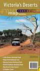
2.
Victoria's Deserts - 4WD Map
Meridian;* Detailed camp ground and facilities information;
* Major 4WD touring routes, such as the Border Track and Murrayville Track;
* Important phone numbers and reference material in the region; and
* Large enough to show all roads, 4WD Tracks and many walking tracks in the region. |
|
|
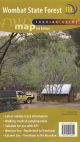
3.
Wombat State Forest - 4WD Map
Meridian; This new map of the area, fully updated and verified, is ideal for four wheel drivers, motor cyclists, mountain bikers, horse riders, bushwalkers, as well as general tourists to the area.
* Points of interest such as mineral springs, old saw mill sites and tramways, picnic and camping areas
* Location of wineries, nurseries and other tourist attractions
* Extensive track network for vehicles, bikes, horses and walkers
* Double sided with overlap through Trentham and Blackwood for easier handling
* Highlighting the Great Dividing Trail and the Wombat Forest Drive
* Access information to local water storages for fishermen |
|
|
4.
Outback Victoria
Westprint |
|
|
5.
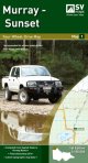
Murray Sunset Map 1
Spatial Vision; SCALE: 1:150,000
COVERAGE: Mildura, Hattah, Border Track, Murray Sunset National Park
IDEAL FOR: Four-Wheel Driving and car touring
EDITION: 1
SIZE: (unfolded): 945mm wide by 750mm high
The Four-Wheel-Drive Map Series includes Victoria?s Iconic 4WD Adventures and authoritative in-depth information on the most popular 4WD regions in Victoria.
The series has been developed in consultation with Victorian Government, Parks Victoria and Four Wheel Drive Victoria.
The latest topographic map base, compiled from up to date VicMap Book data which is field checked by the CFA
Victoria's Iconic 4WD Adventures
Useful tips, track classifications and safety messages
Township maps with street index listings
Features of interest and recreation sites with GPS listings
Major recreational facilities, parks and forests. |
|
|
6.
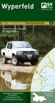
Wyperfeld Map 2
Spatial Vision; SCALE: 1:150,000
COVERAGE: Murrayville, Nhill, Patchewollock, Border Track, Wyperfeld National Park, Big Desert Wilderness Park
IDEAL FOR: Four-Wheel Driving and car touring
EDITION: 1
SIZE (unfolded): 810mm wide by 1000mm high
The Four-Wheel-Drive Map Series includes Victoria's Iconic 4WD Adventures and authoritative in-depth information on the most popular 4WD regions in Victoria.
The series has been developed in consultation with Victorian Government, Parks Victoria and Four Wheel Drive Victoria. |
|
|
7.
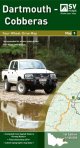
Dartmouth - Cobberas Map 5
Spatial Vision; SCALE: 1:100,000
COVERAGE: Omeo, Mt Anderson Peak, Thredbo, Mt Benambra, Lake Dartmouth
IDEAL FOR: Four-Wheel Driving and car touring
EDITION: 1
SIZE (unfolded): 810mm wide by 1000mm high
The Four-Wheel-Drive Map Series includes Victoria?s Iconic 4WD Adventures and authoritative in-depth information on the most popular 4WD regions in Victoria.
The series has been developed in consultation with Victorian Government, Parks Victoria and Four Wheel Drive Victoria |
|
|
8.
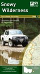
Snowy Wilderness Map7
Spatial Vision; SCALE: 1:100,000
COVERAGE: Orbost, Buchan, Lakes Entrance, Marlo, Snowy River National Park
IDEAL FOR: Four-Wheel Driving and car touring
EDITION: 1
SIZE (unfolded): 810mm wide by 1000mm high
The Four-Wheel-Drive Map Series includes Victoria?s Iconic 4WD Adventures and authoritative in-depth information on the most popular 4WD regions in Victoria.
The series has been developed in consultation with Victorian Government, Parks Victoria and Four Wheel Drive Victoria |
|
|
| |
Your Basket
0 items in basket
|
|

