SOUTHERN HIGHLANDS
MAPS
To order or make enquiries, use
our online
ordering system, email us or call on
02 8850 1044.
 
|
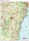
Southern Highlands 12th Edition |
The Southern Highlands map extends from Picton in the North to Nowra in the South & Marulan in the West.
Incuding detailed Street Maps of Berrima, Bong Bong, Bowral, Burradoo, Mittagong & Moss Vale.
District Map Scale 1: 140,000
Street Map Scale 1:26,000
|

|
Southern Highlands Towns & Villages 9th Edition |
The Southern Highlands Towns & Villages Map is a supplement to the Southern Highlands Map.
Including detailed Street Maps of Aylmerton, Balaclava, Balmoral, Braemar, Bundanoon, Burrawang, Colo Vale, Exeter, Fitzroy Falls, Hill Top, Medway, New Berrima, Penrose, Robertson, Sutton Forest, Willow Vale, Wingello & Yerrinbool.
Street Map Scale 1:26,000 |
|
South East Sydney Digital Regional Maps |
South-East New South Wales
Adobe Illustrator EPS file
|

|
Southern Highlands & Wollondilly Street Directory 1st Edition Maps |
Craigies; The Southern Highlands & Wollondilly Street Directory is a Comprehensive Guide to the Streets and Roads within the Southern Highlands and Wollondilly Shires which extends from Warragamba and Silverdale in the North to Wingello in the South.
Including detailed Street Maps of Alpine, Alymerton, Appin , Balmoral, Bargo, Berrima, Berrima Junction, Bowral, Braemar, Bundanoon, Burradoo, Burrawang, Buxton, Colo Vale, Couridjah, Douglas Park, Exeter, Fitzroy Falls, Hill Top, Maldon, Medway, Menangle, Mittagong, Moss Vale, Mowbray Park, Mt Hunter, Oakdale, Penrose, Picton, Robertson, Silverdale, Sutton Forest, Tahmoor, The Oaks, Thirlmere, Warragamba, Welby, Wilton, Wingello, Yanderra, Yerrinbool.
|
Order your Southern Highlands map now - CLICK HERE |
