Home Page    |    Contact Us   

STREET DIRECTORIES SUPPLIERS

NSW - VIC - QLD

Home
About Cartodraft
Contact Us

ONLINE SHOPPING

Browse online shop

Delivery and Order Information

CRAIGIES MAPS

- Visitors Maps
- Touring Maps
- State Maps
- Street Directories
- Laminated Maps

WALL MAPS

- Laminated

EDUCATIONAL WALL MAPS

- World Political
- Australia and its Neighbours
- Australia Political
- Australia Physical
- New South Wales

POSTCODE MAPS

- Postcode Maps

CUSTOM MAPPING

- Custom Mapping Services
- Showcase

MAP ENLARGEMENTS

- Mapping Enlargements

WEBSITE MAPPING

- Maps for websites
- Showcase

LAMINATING SERVICE

- Lamination Services

PRINTING SERVICE

- Printing Services

DIGITAL MAPS

- International
- Australian
- New Zealand

GPS

- Hema Navigator

GROOVY MAPS

- Maps & Guides

SATELLITE MAPS AND POSTERS

- Satellite Maps and Posters

TOPOGRAPHIC MAPS

- NSW Lands
- NATMAP 1:50,000
- NATMAP 1:100,000
- NATMAP 1:250,000
- National
- NATMAP PNG
- Raster CD & DVD

MAP AND PLAN MEASURING TOOLS

- Scalex Map Wheel™
- Scalex Plan Wheel™

CARTOGRAPHY BOOKS

- Getting there from Here
- The States of a Nation

PROMOTIONAL PRODUCTS

- Desk Pads, Courtesy maps and more

CD AND DVD PRODUCTS

- Digital Street Directories
- Postcodes Australia and DVD Products
- Topographic Maps and DVD Products
- CD Maps

INTERNATIONAL MAPS

- Countries/Regions A-D
- Countries/Regions E-H
- Countries/Regions I-L
- Countries/Regions M-P
- Countries/Regions S-U
- Groovy Map 'n Guide

STREET DIRECTORIES

- Street Directory -ACT
- Street Directory -NSW
- Street Directory -NT
- Street Directory -QLD
- Street Directory -SA
- Street Directory -VIC
- Street Directory -WA
- Street Directory -NZ

ATLASES AND GUIDES

- Road Atlases
- Touring & Recreational Guides

TOURING MAPS

- City to City Touring Maps

WORLD MAPS

- World Maps

AUSTRALIAN MAPS

- Australian Maps

FORESTRY MAPS

- Forestry Maps - NSW

NATIONAL PARK MAPS

- National Park Maps - NSW
- National Park Maps - Vic
- National Park Maps - Qld
- National Park Maps - Tas

4WD MAPS & GUIDES

- Great Desert Track Series
- 4 Wheel Driving Maps
- 4 Wheel Driving Guides
- 4 Wheel Driving CD's

CITY MAPS

- Major Cities A-B
- Major Cities C-L
- Major Cities M-P
- Major Cities S-Z
- Regional Cities

REGIONAL MAPS

- Regional Maps -NSW
- Regional Maps -NT
- Regional Maps -QLD
- Regional Maps -SA
- Regional Maps -VIC
- Regional Maps -WA
- Regional Maps -TAS

STATE MAPS

- State Maps -NSW
- State Maps -NT
- State Maps -Queensland
- State Maps -SA
- State Maps -Victoria
- State Maps -WA
- State Maps -Tasmania

NEW ZEALAND MAPS

- New Zealand - Atlases
- New Zealand - Maps
- New Zealand - City Maps
- New Zealand - Street Directories
- New Zealand - Regional Maps
- New Zealand - Laminated Maps
Awards
Links
Terms and conditions
Privacy Policy
Information Request/Contact

Craigie’s Street Directories

To order or make enquiries - use our online ordering system - email us or call on 02 8850 1044.

Some samples of our range include:


craigies street directories - maps - Bawley Point - Bendalong - Berrara - Berry - Bomaderry - Burrill Lake - Callala Bay - Callala Beach - Cambewarra Village - Cudmirrah,Culburra Beach - Cunjurong Point - Currarong - Durras North - Erowal Bay - Greenwell Point - Huskisson - Hyams Beach - Kangaroo Valley - Kioloa - Lake Conjola - Lake Tabourie - Manyana - Milton - Mollymook - Narrawallee - Nowra - Old Erowal Bay - Orient Point - St. Georges Basin - Sanctuary Point - Shoalhaven Heads - Sussex Inlet - Ulladulla - Vincentia & Worrigee    STREET DIRECTORIES
 
Shoalhaven – The Shoalhaven Street Directory is a Comprehensive Guide to the Streets and Roads within The City of Shoalhaven which extends from Berry & Kangaroo Valley in the North to Durras in the South. Detailed street maps of Bangalee, Basin View, Bawley Point, Bendalong, Berrara, Berry, Bomaderry, Burrill Lake, Callala Bay, Callala Beach, Cambewarra Village, Cudmirrah, Culburra Beach, Cunjurong Point, Currarong, Durras North, Erowal Bay, Greenwell Point, Huskisson, Hyams Beach, Kangaroo Valley, Kioloa, Lake Conjola, Lake Tabourie, Manyana, Milton, Mollymook, Narrawallee, Nowra, Old Erowal Bay, Orient Point, St. Georges Basin, Sanctuary Point, Shoalhaven Heads, Sussex Inlet, Ulladulla, Vincentia & Worrigee.
 
craigies street directories - maps - Alpine - Alymerton - Appin - Balmoral - Bargo - Berrima - Berrima Junction - Bowral - Braemar - Bundanoon - Burradoo - Burrawang - Buxton - Colo Vale - Couridjah - Douglas Park - Exeter - Fitzroy Falls - Hill Top - Maldon - Medway - Menangle - Mittagong - Moss Vale - Mowbray Park - Mt Hunter - Oakdale - Penrose - Picton - Robertson - Silverdale - Sutton Forest - Tahmoor - The Oaks - Thirlmere - Warragamba - Welby - Wilton - Wingello - Yanderra - Yerrinbool  
Southern Highlands and Wollondilly – The Southern Highlands & Wollondilly Street Directory is a Comprehensive Guide to the Streets and Roads within the Southern Highlands and Wollondilly Shires which extends from Warragamba and Silverdale in the North to Wingello in the South. Detailed Street Maps of Alpine, Alymerton, Appin , Balmoral, Bargo, Berrima, Berrima Junction, Bowral, Braemar, Bundanoon, Burradoo, Burrawang, Buxton, Colo Vale, Couridjah, Douglas Park, Exeter, Fitzroy Falls, Hill Top, Maldon, Medway, Menangle, Mittagong, Moss Vale, Mowbray Park, Mt Hunter, Oakdale, Penrose, Picton, Robertson, Silverdale, Sutton Forest, Tahmoor, The Oaks, Thirlmere, Warragamba, Welby, Wilton, Wingello, Yanderra, Yerrinbool.
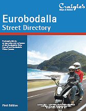
 
craigies street directories - maps - Barling Beach - Batehaven - Batemans Bay - Bermagui - Bodalla - Broulee - Catalina - Central Tilba - Cobargo - Congo - Dalmeny - Denhams Beach - Durras - Durras Lake - Garlandtown - Guerilla Bay - Kianga - Lilli Pilli - Long Beach - Maloneys Beach - Malua Bay - Mogo - Moruya - Moruya Heads - Mossy Point - Mystery Bay - Narooma - Nelligen - North Narooma - North Rosedale - Potato Point - Rosedale - Sunshine Bay - Surfbeach - Surfside - The Anchorage - Tilba Tilba - Tomakin - Tuross Head  
Eurobodalla – The Eurobodalla Street Directory is a comprehensive guide to the streets and roads within the Eurobodalla Shire which extends from Durras in the north to Bermagui in the south. Detailed street maps of Barling Beach, Batehaven , Batemans Bay, Bermagui, Bodalla, Broulee, Catalina, Central Tilba, Cobargo, Congo, Dalmeny, Denhams Beach, Durras, Durras Lake, Garlandtown, Guerilla Bay, Kianga, Lilli Pilli, Long Beach, Maloneys Beach, Malua Bay, Mogo, Moruya, Moruya Heads, Mossy Point, Mystery Bay, Narooma, Nelligen, North Narooma, North Rosedale, Potato Point, Rosedale, Sunshine Bay, Surfbeach, Surfside, The Anchorage, Tilba Tilba, Tomakin, Tuross Head.
 

FOR OUR RANGE OF CRAIGIE'S STREET DIRECTORIES CLICK HERE


   Copyright Cartodraft P/L 2001-2010. 

Websites by Netmastery

Contact Cartodraft