|
1.
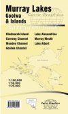
Murray Lakes, Goolwa and Islands
Cartographics: A double sided map covering the complete Lakes Alexandrina and Albert. Printed on waterproof, durable paper. 1:100 000 Wellington to Goolwa, 1:50 000 Pomanda Channel inset, 1:50 000 Milang/goolwa/islands and 1:25 000 inset Goolwa and Hindmarsh Marina. Size 828 x 500mm |
|

|
2.
Murray River Access: Albury-Wodonga to Mulwala
Spatial Vision: Book 3 Size - 594 x 210 mm
Designed for visitors touring the area, the booklet has information regarding recreation facilities including camping, boating and fishing within Albury-Wodonga and Yarrawonga-Mulwala, including major walks. The guide has been produced with the support of Corowa Shire Council, Rutherglen Wine Experience, Destination Albury Wodonga, Department of Sustainability and Environment, Parks Victoria, Forests NSW, NSW Maritime, and local businesses. The Murray River Guides are a great way to find the best camping and fishing spots, plan your adventure and make the most of what our great river has to offer. They are also the ideal maps for the Murray River Marathon. |
|

|
3.
Murray River Access: Barmah to Torrumbarry Weir
Spatial Vision: Size - 594 x 210 mm
Designed for visitors touring the area, the booklet has information regarding recreation facilities including camping, boating and fishing within NSW and Victorian Parks and Forests, and major walks. The guide has been produced with the support of Echuca-Moama Tourism, Park Victoria and local businesses. The Murray River Guides are a great way to find the best camping and fishing spots, plan your adventure and make the most of what our great river has to offer. They are also the ideal maps for the Murray River Marathon. |
|

|
4.
Murray River Access: Blanchetown/Swan
Spatial Vision: Book 15 Size - 594 x 210 mm
Designed for visitors touring Blanchetown, Swan Reach, Nildottie, Walker Flat, Purnong, Younghusband or Mannum, this booklet has information regarding recreation facilities including camping, boating and fishing within South Australia. The Murray River Access Guides are a great way to find the best camping and fishing spots, plan your adventure and make the most of what our great river has to offer. |
|

|
5.
Murray River Access: Gunbower Island to Murrabit
Spatial Vision: Size - 594 x 210 mm
Designed for visitors touring the area, the booklet has information regarding recreation facilities including camping, boating and fishing within Gunbower Island, Cohuna, Barham-Koondrook and Murrabit, including major walks. This guide has been produced with the support of Golden Rivers Tourism, Department of Sustainability and Environment, Parks Victoria, Forests NSW, and local businesses. The Murray River Guides are a great way to find the best camping and fishing spots, plan your adventure and make the most of what our great river has to offer. They are also the ideal maps for the Murray River Marathon. |
|

|
6.
Murray River Access: Jingellic to Murray Source
Spatial Vision: Book 12 Size - 594 x 210 mm
Designed for visitors touring the area, the booklet has information regarding recreation facilities including camping, boating and fishing within Jingellic, Walwa, Tintaldra, Towong, Corryong, Khancoban and Murray Source, including major walks. |
|

|
7.
Murray River Access: Lake Hume to Tallangatta
Spatial Vision: Book 6 Size - 594 x 210 mm
Designed for visitors touring the area, the booklet has information regarding recreation facilities including camping, boating and fishing from Lake Hume to Tallangatta including major walks. The guide has been produced with the support of Moira Shire, Park Victoria, Forests NSW and local businesses. The Murray River Guides are a great way to find the best camping and fishing spots, plan your adventure and make the most of what our great river has to offer. They are also the ideal maps for the Murray River Marathon. 594 x 210 mm |
|

|
8.
Murray River Access: Mannum to Murray Mouth
Spatial Vision: Book 16 Size - 594 x 210 mm
Designed for visitors touring Mannum, Murray Bridge, Tailem Bend, Milang, Lake Albert, Meningie, Lake Alexandrina, Goolwa, Coorong National Park, and the Murray Mouth, this booklet has information regarding recreation facilities including camping, boating and fishing within South Australia. The Murray River Access Guides are a great way to find the best camping and fishing spots, plan your adventure and make the most of what our great river has to offer. |
|

|
9.
Murray River Access: Mildura to Neds Corner
Spatial Vision: Book 9 Size - 594 x 210 mm
Designed for visitors touring the area, the booklet has information regarding recreation facilities including camping, boating and fishing within Mildura, Wentworth and Ned's Corner, including major walks. The guide has been produced with the support of Wentworth Shire Council, Mildura Rural City Council, Parks Victoria, Mallee CMA, Forests NSW, Department of Sustainability and Environment, and local businesses. The Murray River Guides are a great way to find the best camping and fishing spots, plan your adventure and make the most of what our great river has to offer. They are also the ideal maps for the Murray River Marathon. |
|

|
10.
Murray River Access: Murrabit to Tooleybuc
Spatial Vision: Book zz Size - 594 x 210 mm
Designed for visitors touring the area, the booklet has information regarding recreation facilities including camping, boating and fishing within Murrabit, Lake Boga, Swan Hill, Murray Downs, Nyah West and Tooleybuc, including major walks. The Murray River Guides are a great way to find the best camping and fishing spots, plan your adventure and make the most of what our great river has to offer. They are also the ideal maps for the Murray River Marathon. |
|

|
11.
Murray River Access: Neds Corner to Paringa
Spatial Vision: Book 10, Size - 594 x 210 mm
Designed for visitors touring the area, the booklet has information regarding recreation facilities including camping, boating and fishing within Ned's Corner, Lindsay Island, Chowilla and Renmark to Paringa including major walks. The Murray River Guides are a great way to find the best camping and fishing spots, plan your adventure and make the most of what our great river has to offer. They are also the ideal maps for the Murray River Marathon. |
|

|
12.
Murray River Access: Renmark to Waikerie
Spatial Vision: Book 13, Size - 594 x 210 mm
Designed for visitors touring the area, the booklet has information regarding recreation facilities including camping, boating and fishing within Renmark, Paringa, Berri, Loxton, Barmera and Waikerie including major walks. The guide has been produced with the support of Moira Shire, Park Victoria, Forests NSW and local businesses. The Murray River Guides are a great way to find the best camping and fishing spots, plan your adventure and make the most of what our great river has to offer. They are also the ideal maps for the Murray River Marathon. |
|

|
13.
Murray River Access: Tooleybuc to Wemen
Spatial Vision: Size - 594 x 210 mm
Designed for visitors touring the area, the booklet has information regarding recreation facilities including camping, boating and fishing within Tooleybuc, Boundary Bend, Robinvale, Euston and Wemen, including major walks. The Murray River Guides are a great way to find the best camping and fishing spots, plan your adventure and make the most of what our great river has to offer. They are also the ideal maps for the Murray River Marathon. |
|

|
14.
Murray River Access: Ulupna Island to Denliquin
Spatial Vision: Book 11, Size - 594 x 210 mm
Designed for visitors touring the area, the booklet has information regarding recreation facilities including camping, boating and fishing within Ulupna Island, Barmah, Edward River, Mathoura and Deniliquin, including major walks. The Murray River Guides are a great way to find the best camping and fishing spots, plan your adventure and make the most of what our great river has to offer. They are also the ideal maps for the Murray River Marathon. |
|

|
15.
Murray River Access: Wemen to Mildura
Spatial Vision: Size - 594 x 210 mm
Designed for visitors touring the area, the booklet has information regarding recreation facilities including camping, boating and fishing within Wemen, Colignan, Kings Billabong, Gol Gol, Buronga and Mildura, including major walks. The Murray River Guides are a great way to find the best camping and fishing spots, plan your adventure and make the most of what our great river has to offer. They are also the ideal maps for the Murray River Marathon. |
|

|
16.
Murray River Access: Yarrawonga-Mulwala to Ulupna Island
Spatial Vision: Size - 594 x 210 mm
Designed for visitors touring the area, the booklet has information regarding recreation facilities including camping, boating and fishing from Yarrawonga to Mulwala, Cobram to Barooga, Tocumwal and Ulupna Island, including major walks. The guide has been produced with the support of Moira Shire, Park Victoria, Forests NSW and local businesses. The Murray River Guides are a great way to find the best camping and fishing spots, plan your adventure and make the most of what our great river has to offer. They are also the ideal maps for the Murray River Marathon. |
|

|
17.
Murray River Access: Waikene to Blanchtown
Spatial Vision: Size - 594 x 210 mm
Designed for visitors touring the area, the booklet has information regarding recreation facilities including camping, boating and fishing within NSW and Victorian Parks and Forests, and major walks. The guide has been produced with the support of Moira Shire, Park Victoria, Forests NSW and local businesses.
The Murray River Guides are a great way to find the best camping and fishing spots, plan your adventure and make the most of what our great river has to offer. They are also the ideal maps for the Murray River Marathon.
Waikerie, Cadell, Morgan, Blanchetown |
|
|
| |
Your Basket
0 items in basket
|
|


