|
1.
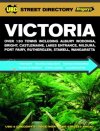
Victoria
UBD Greg; 20 Melbourne & Surrounds Suburb Maps
Over 110 updated City & Town Maps, including Ararat, Bendigo, Casterton, Drouin, Lakes Entrance, Merbein, Ouyen, Portland, Sale & Wonthaggi
38 Victorian Road Atlas Maps & Index
Editorial on 10 regional areas of Victoria : Melbourne; Mornington Peninsula/Phillip Island; Yarra Valley, Dandenong, & The Ranges; Macedon Ranges & Spa Country; Great Ocean Road; Gippsland; Goldfields; Grampians; Legends, Wine & High Country and The Murray
All City & Town maps have updated Places of Interest, Events, Accommodation, Facilities & Advertisers Guide
Distance & National Parks Chart |
|
|
2.
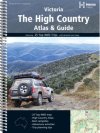
The High Country Atlas & Guide
Hema; In depth coverage of the High Country, Victoria from Mansfield to the Snowy River National park, the ski fields at Perisher Valley to Lakes Entrance. Spiral Bound |
|
|
3.
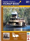
VicMap Books North West Region
Spatial Vision 4th Edition 25cm wide and 34cm high
'Unlike many map books, this one has everything needed by the serious off road navigator' Robert Pepper, Trackwatch Magazine.'
IDEAL FOR: Four wheel driving, camping, bushwalking, mountain biking, fishing, business travel and car touring.
MAJOR NATIONAL AND STATE PARKS: Big Desert, Greater Bendigo, Hattah - Kulkyne, Heathcote - Graytown, Kooyoora, Murray Sunset, Paddys Ranges, St Arnaud and Wyperfeld.
SCALE: North West Region: 1:100,000 Selected areas: 1:50,000 Township maps: 1:20,000 Bendigo: 1:15,000
COVERAGE: Both sides of the Murray River south-east from the South Australian border to Barmah, south-east to Undera and Tatura, south to Avenel, south-west through Pyalong, Newham, Macedon, Mount Macedon, Woodend, Tylden and Kyneton, west through Malmsbury to Elmhurst, north-west through Navarre, Wallaloo East, Marnoo, Brim and Beulah, west to the South Australian border and north to the Murray River.
Note: In most places this edition extends at least 20kms into both the New South Wales and South Australian borders. |
|
|
4.
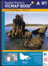
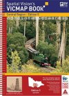
VicMap Books South East Region
Spatial Vision 3rd Edition 25cm wide and 34cm high
IDEAL FOR: Four wheel driving, camping, bushwalking, mountain biking, fishing, business travel and car touring.
MAJOR NATIONAL AND STATE PARKS: Yarra Ranges, Bunyip, Cape Liptrap, Wilsons Promontory, Moondarra, Baw Baw, Tarra-Bulga, Alpine, Avon, Holey Plains, Mitchell River, Gippsland Lakes, The Lakes, Lake Tyres, Snowy River, Kosciuszko, Cape Conran, Errinundra, Lind, Coopracambra, Alfred, Croajingolong, Nadgee.
Note: In most places this edition extends at least 20 kms over New South Wales border.
SCALE: South East Region: 1:100,000 Selected areas: 1:50,000 Township maps: 1:20,000 Wilsons Promontory: 1:150,000
COVERAGE:
Both sides of the Murray River
South West to Wonthaggi, Inverloch, Korumburra, Fish Creek, Buffalo, Leongatha, Wilsons Promontory
South East to Mallacoota, Gabo Island
South to Lakes Entrance, Bairnsdale, Orbost, Bruthen, Golden Beach ? Paradise Beach, Flamingo Beach
North West to Marysville, Healesville ? Badger Creek, Woods Point, Baw Baw Alpine Village
North to Mount Buller Alpine Village, Towonga, Mt Beauty ? Tawonga South, Falls Creek. |
|
|
5.
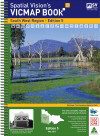
VicMap Books Central Region
Spatial Vision 4th Edition 25cm wide and 34cm high
IDEAL FOR: Four wheel driving, camping, bushwalking, mountain biking, fishing, business travel and car touring.
MAJOR NATIONAL AND STATE PARKS: Brisbane Ranges, Bunyip, Cathedral Ranges, Enfield, French Island, Great Otway, Kinglake, Lerderderg, Paddys Ranges and Yarra Ranges.
SCALE: Metropolitan and regional: 1:50,000; Township maps:1:20:000; Ballarat: 1:15,000
COVERAGE: North from Apollo Bay to Natte Yallock, east through Dunolly, Maldon, Castlemaine to Broadford, south to Waterford Park, east through Buxton and Marysville to Woods Point, South to Baw Baw Alpine Village and south-west through Drouin to Inverloch |
|
|
6.
VicMap Books South West Region
Spatial Vision 3rd Edition 25cm wide and 34cm high
IDEAL FOR: Four wheel driving, camping, bushwalking, mountain biking, fishing, business travel and car touring
MAJOR NATIONAL AND STATE PARKS: Great Otway, Port Campbell, Grampians, Kooyoora, Little Dessert, Wyperfeld, Cobboboonee, Mount Eccles, St Arnaud, Dergholm, Cape Nelson, Lower Glenelg, Mount Arapiles ? Tooan, Paddys Ranges, Mount Buangor, Enfield, Black Range, Mount Napier, Langi Ghiran, Mount Richmond.
SCALE: South West Region: 1:100,000 Selected areas: 1:50,000 Township maps: 1:20,000
Note: In most places this edition extends at least 20kms into South Australia.
COVERAGE: South west from the South Australian border to Mount Gambier, Edenhope, Nelson, Casterton, Coleraine, Balmoral, Portland, south to˙ Port Fairy, Warnambool, Hamilton, Penhurst, Dunkeld, south east to Apollo Bay, Colac, Camperdown, Lake Bolac, east to Halls Gap, Ararat, Beaufort, Scaresdale Smythesdale, Maryborough, Carisbrook, north east to Stawell, St Arnaud, Charlton, north to Horsham, Dimboola, Warracknabeal, Hopetoun and west to Nhill, Kaniva, Bordertown. |
|
|
7.
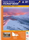
VicMap Books North East Region
Spatial Vision 5th Edition 25cm wide and 34cm high
IDEAL FOR: Four wheel driving, camping, bushwalking, mountain biking, fishing, business travel and car touring
MAJOR NATIONAL AND STATE PARKS: Alpine, Barmah, Cathedral Range, Chiltern-Mt Pilot, Dargo, Kinglake, Lake Eildon, Mitta Mitta, Mount Buffalo, Mount Buller, Murray Valley, Rushworth-Heathcote, Tallangatta, Toolangi, Wabba, Warby-Ovens, Yarra Ranges.
Note: In most places this edition extends at least 20kms into both the New South Wales border.
SCALE: North East Region: 1:100,000 Selected areas: 1:50,000 Township maps: 1:20,000
COVERAGE: Both sides of the Murray River, south west to Riddles Creek, Kinglake, Wallan, Kilmore, Broadford, Seymour, Puckapunyal, Euroa, south to Marysville, Healesville, Yarra Glen, Alexandra, Mansfield, Mount Buller south east to Whitfield Chesnut, Wandilgong, Mount Beauty Tawonga South, Bright, Hotham Heights north east to Myrtleford, Beechworth, Allans Flat Osbourne Flat, Baranduda, Albury Wodonga, north to Wangaratta, Corowa Wahgunyah, north west to Benalla, Cobram Barooga, Tocumwal, Finley and west to Shepparton, Tatura, Kyabram, Echuca, Rochester. |
|
|
| |
Your Basket
0 items in basket
|
|

