Home Page    |   Contact Us    

SHOALHAVEN MAP SUPPLIERS

NSW

Home
About Cartodraft
Contact Us

ONLINE SHOPPING

Browse online shop

Delivery and Order Information

CRAIGIES MAPS

- Visitors Maps
- Touring Maps
- State Maps
- Street Directories
- Laminated Maps

WALL MAPS

- Laminated

EDUCATIONAL WALL MAPS

- World Political
- Australia and its Neighbours
- Australia Political
- Australia Physical
- New South Wales

POSTCODE MAPS

- Postcode Maps

CUSTOM MAPPING

- Custom Mapping Services
- Showcase

MAP ENLARGEMENTS

- Mapping Enlargements

WEBSITE MAPPING

- Maps for websites
- Showcase

LAMINATING SERVICE

- Lamination Services

PRINTING SERVICE

- Printing Services

DIGITAL MAPS

- International
- Australian
- New Zealand

GPS

- Hema Navigator

GROOVY MAPS

- Maps & Guides

SATELLITE MAPS AND POSTERS

- Satellite Maps and Posters

TOPOGRAPHIC MAPS

- NSW Lands
- NATMAP 1:50,000
- NATMAP 1:100,000
- NATMAP 1:250,000
- National
- NATMAP PNG
- Raster CD & DVD

MAP AND PLAN MEASURING TOOLS

- Scalex Map Wheel™
- Scalex Plan Wheel™

CARTOGRAPHY BOOKS

- Getting there from Here
- The States of a Nation

PROMOTIONAL PRODUCTS

- Desk Pads, Courtesy maps and more

CD AND DVD PRODUCTS

- Digital Street Directories
- Postcodes Australia and DVD Products
- Topographic Maps and DVD Products
- CD Maps

INTERNATIONAL MAPS

- Countries/Regions A-D
- Countries/Regions E-H
- Countries/Regions I-L
- Countries/Regions M-P
- Countries/Regions S-U
- Groovy Map 'n Guide

STREET DIRECTORIES

- Street Directory -ACT
- Street Directory -NSW
- Street Directory -NT
- Street Directory -QLD
- Street Directory -SA
- Street Directory -VIC
- Street Directory -WA
- Street Directory -NZ

ATLASES AND GUIDES

- Road Atlases
- Touring & Recreational Guides

TOURING MAPS

- City to City Touring Maps

WORLD MAPS

- World Maps

AUSTRALIAN MAPS

- Australian Maps

FORESTRY MAPS

- Forestry Maps - NSW

NATIONAL PARK MAPS

- National Park Maps - NSW
- National Park Maps - Vic
- National Park Maps - Qld
- National Park Maps - Tas

4WD MAPS & GUIDES

- Great Desert Track Series
- 4 Wheel Driving Maps
- 4 Wheel Driving Guides
- 4 Wheel Driving CD's

CITY MAPS

- Major Cities A-B
- Major Cities C-L
- Major Cities M-P
- Major Cities S-Z
- Regional Cities

REGIONAL MAPS

- Regional Maps -NSW
- Regional Maps -NT
- Regional Maps -QLD
- Regional Maps -SA
- Regional Maps -VIC
- Regional Maps -WA
- Regional Maps -TAS

STATE MAPS

- State Maps -NSW
- State Maps -NT
- State Maps -Queensland
- State Maps -SA
- State Maps -Victoria
- State Maps -WA
- State Maps -Tasmania

NEW ZEALAND MAPS

- New Zealand - Atlases
- New Zealand - Maps
- New Zealand - City Maps
- New Zealand - Street Directories
- New Zealand - Regional Maps
- New Zealand - Laminated Maps
Awards
Links
Terms and conditions
Privacy Policy
Information Request/Contact

SHOALHAVEN MAPS

To order or make enquiries, use our online ordering system, email us or call on 02 8850 1044.

Click to order maps

South Coast & New South Wales 4th Edition


The South Coast Map extends from Sydney in the North and to Bairnsdale in the South.
Including a detailed Map of New South Wales on the reverse.
Region Map Scale 1:1,000,000
New South Wales Map Scale 1:2,500,000

Click to order NSW Postcode Maps

South East Sydney Digital Regional Maps

South-East New South Wales

Adobe Illustrator EPS file

Click to order NSW Postcode Maps

Shoalhaven Street Directory 7th Edition Maps

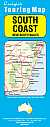
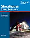
Craigies; The Shoalhaven Street Directory is a Comprehensive Guide to the Streets and Roads within The City of Shoalhaven which extends from Berry & Kangaroo Valley in the North to Durras in the South.

Including detailed Street Maps of Bangalee, Basin View, Bawley Point, Bendalong, Berrara, Berry, Bomaderry, Burrill Lake, Callala Bay, Callala Beach, Cambewarra Village, Cudmirrah, Culburra Beach, Cunjurong Point, Currarong, Durras North, Erowal Bay, Greenwell Point, Huskisson, Hyams Beach, Kangaroo Valley, Kioloa, Lake Conjola, Lake Tabourie, Manyana, Milton, Mollymook, Narrawallee, Nowra, Old Erowal Bay, Orient Point, St. Georges Basin, Sanctuary Point, Shoalhaven Heads, Sussex Inlet, Ulladulla, Vincentia & Worrigee.

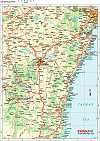
District Map Scale 1:110,000
Street Map Scale 1:26,000

Image not Available

Regional Maps-South Coast

UBD; Size 690 x 920mm

Click link for regional maps for batemans bay and other south coast areas.

Order your Shoalhaven map now - CLICK HERE

Cartodraft provides a range of maps, cartography tools, map wheels, map planning tools, digital guides, topographic and satellite maps and much more. Tourist maps, 4WD maps and various other articles are all available online.

   Copyright Cartodraft Pty Ltd 2001-2024  

Contact Cartodraft